
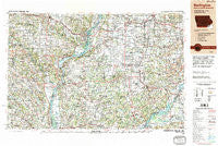
~ Burlington IA topo map, 1:250000 scale, 1 X 2 Degree, Historical, 1990, updated 1990
Burlington, Iowa, USGS topographic map dated 1990.
Includes geographic coordinates (latitude and longitude). This topographic map is suitable for hiking, camping, and exploring, or framing it as a wall map.
Printed on-demand using high resolution imagery, on heavy weight and acid free paper, or alternatively on a variety of synthetic materials.
Topos available on paper, Waterproof, Poly, or Tyvek. Usually shipping rolled, unless combined with other folded maps in one order.
- Product Number: USGS-5283811
- Free digital map download (high-resolution, GeoPDF): Burlington, Iowa (file size: 18 MB)
- Map Size: please refer to the dimensions of the GeoPDF map above
- Weight (paper map): ca. 55 grams
- Map Type: POD USGS Topographic Map
- Map Series: HTMC
- Map Verison: Historical
- Cell ID: 68696
- Scan ID: 174220
- Imprint Year: 1990
- Woodland Tint: Yes
- Visual Version Number: 2
- Edit Year: 1990
- Datum: NAD83
- Map Projection: Universal Transverse Mercator
- Map published by United States Geological Survey
- Map Language: English
- Scanner Resolution: 600 dpi
- Map Cell Name: Burlington
- Grid size: 1 X 2 Degree
- Date on map: 1990
- Map Scale: 1:250000
- Geographical region: Iowa, United States
Neighboring Maps:
All neighboring USGS topo maps are available for sale online at a variety of scales.
Spatial coverage:
Topo map Burlington, Iowa, covers the geographical area associated the following places:
- Colchester - Greenbush - Loraine - Galesburg - Elderville - Ponemah - Bricker - Primrose - Monticello - Pleasant Hill (historical) - Olena - Forty Acres - Mount Clare - Summum - Echo Valley Mobile Home Park - Galland - Salem - Clear Lake - Virgil (historical) - Erwin - Sharon - New Court Village - Hopper - Pleasant Grove - Breckenridge - Uniontown - Knox - Dumas - New Boston - Burnside (historical) - Lockridge - West Burlington - Dodgeville - Ormonde - Bader - Trenton Corners - Doddsville - Canton - Midway - Hale Ridge (historical) - Vernon - Bowen - Swan Creek - Lamone Village - Jeffersonville (historical) - La Crosse - McCall - Elba Center - Gulfport - Mount Sterling - Birmingham - Denova - Chambersburg - Walnut Grove - Fowler - Gerlaw - Birmingham - University Village - Chatton - Ray - Browning - Beardstown - Timewell - New Lancaster (historical) - Waterloo - Kilbourn - Anson - Wolf Lake - Rock Creek - Montrose - Webster - Fandon - Bluff Park - Bridgeport (historical) - Brereton - Bentley - Astoria - Chautauqua Park - West Point - Cameron - Bentonsport - Bybee - Jeddo - Lomax - Bryant - Argyle - Silver Lake (historical) - Russellville (historical) - Spring Grove - Camden - Prospect Heights Addition - Middletown - Ferris - Wayland - Sugar Creek (historical) - Decorra - Gladstone - Mooar - Warsaw - Williamstown
- Map Area ID: AREA4140-92-90
- Northwest corner Lat/Long code: USGSNW41-92
- Northeast corner Lat/Long code: USGSNE41-90
- Southwest corner Lat/Long code: USGSSW40-92
- Southeast corner Lat/Long code: USGSSE40-90
- Northern map edge Latitude: 41
- Southern map edge Latitude: 40
- Western map edge Longitude: -92
- Eastern map edge Longitude: -90


