
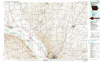
~ Sioux City North IA topo map, 1:100000 scale, 30 X 60 Minute, Historical, 1986, updated 1992
Sioux City North, Iowa, USGS topographic map dated 1986.
Includes geographic coordinates (latitude and longitude). This topographic map is suitable for hiking, camping, and exploring, or framing it as a wall map.
Printed on-demand using high resolution imagery, on heavy weight and acid free paper, or alternatively on a variety of synthetic materials.
Topos available on paper, Waterproof, Poly, or Tyvek. Usually shipping rolled, unless combined with other folded maps in one order.
- Product Number: USGS-5283729
- Free digital map download (high-resolution, GeoPDF): Sioux City North, Iowa (file size: 21 MB)
- Map Size: please refer to the dimensions of the GeoPDF map above
- Weight (paper map): ca. 55 grams
- Map Type: POD USGS Topographic Map
- Map Series: HTMC
- Map Verison: Historical
- Cell ID: 68372
- Scan ID: 175538
- Imprint Year: 1992
- Woodland Tint: Yes
- Photo Inspection Year: 1990
- Aerial Photo Year: 1983
- Edit Year: 1986
- Datum: NAD27
- Map Projection: Universal Transverse Mercator
- Map published by United States Geological Survey
- Map Language: English
- Scanner Resolution: 600 dpi
- Map Cell Name: Sioux City North
- Grid size: 30 X 60 Minute
- Date on map: 1986
- Map Scale: 1:100000
- Geographical region: Iowa, United States
Neighboring Maps:
All neighboring USGS topo maps are available for sale online at a variety of scales.
Spatial coverage:
Topo map Sioux City North, Iowa, covers the geographical area associated the following places:
- Junction City - Westfield - Riverside - James - Spink - Wren - McNally - Tallview Terrace Mobile Home Park - Struble - Ionia (historical) - Plymouth (historical) - Vermillion - Akron - Millnerville - Mammen - Hub City - Newcastle - Alton - Potosia - Ruble - Brookdale - Maskell - Ponca - Burbank - Neptune - Armel Acres Mobile Home Estates - Carnes - Martinsburg - Hoffmans Trailer Court - Emmet - Dalesburg - Hinton - O'Leary - McKays Trailer Court - Big Springs - Brunsville - Parkview Terrace - Merrill - Marshalltown (historical) - Clay Point - Hill Side - Greenfield - Lime Grove - Nora - Lodi - Alsen - Twilight Trailer Court - Chatsworth - Candlelight Village Mobile Home Park - Jefferson - Lembke Landing - Springdale - Union Center - Hawarden - Craig - Midway - Maurice - Holiday Village - Richland - West Le Mars - Crathorne - Elk Point - Yeomans - Adaville - Le Mars - Leeds - Ireton - North Sioux City - Seney - Oyens - Bloomingdale - McCook Lake - Mount Lucia - Erdmann Trailer Court - Evergreen Village
- Map Area ID: AREA4342.5-97-96
- Northwest corner Lat/Long code: USGSNW43-97
- Northeast corner Lat/Long code: USGSNE43-96
- Southwest corner Lat/Long code: USGSSW42.5-97
- Southeast corner Lat/Long code: USGSSE42.5-96
- Northern map edge Latitude: 43
- Southern map edge Latitude: 42.5
- Western map edge Longitude: -97
- Eastern map edge Longitude: -96


