
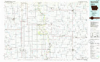
~ Rock Rapids IA topo map, 1:100000 scale, 30 X 60 Minute, Historical, 1985, updated 1985
Rock Rapids, Iowa, USGS topographic map dated 1985.
Includes geographic coordinates (latitude and longitude). This topographic map is suitable for hiking, camping, and exploring, or framing it as a wall map.
Printed on-demand using high resolution imagery, on heavy weight and acid free paper, or alternatively on a variety of synthetic materials.
Topos available on paper, Waterproof, Poly, or Tyvek. Usually shipping rolled, unless combined with other folded maps in one order.
- Product Number: USGS-5283725
- Free digital map download (high-resolution, GeoPDF): Rock Rapids, Iowa (file size: 12 MB)
- Map Size: please refer to the dimensions of the GeoPDF map above
- Weight (paper map): ca. 55 grams
- Map Type: POD USGS Topographic Map
- Map Series: HTMC
- Map Verison: Historical
- Cell ID: 68249
- Scan ID: 175438
- Imprint Year: 1985
- Woodland Tint: Yes
- Aerial Photo Year: 1984
- Edit Year: 1985
- Datum: NAD27
- Map Projection: Universal Transverse Mercator
- Planimetric: Yes
- Map published by United States Geological Survey
- Map Language: English
- Scanner Resolution: 600 dpi
- Map Cell Name: Rock Rapids
- Grid size: 30 X 60 Minute
- Date on map: 1985
- Map Scale: 1:100000
- Geographical region: Iowa, United States
Neighboring Maps:
All neighboring USGS topo maps are available for sale online at a variety of scales.
Spatial coverage:
Topo map Rock Rapids, Iowa, covers the geographical area associated the following places:
- Beloit - Hull - Alcester - Inwood - Middleburg - Moe - Lakewood (historical) - Fairview - Shindler - Larchwood - Alvord - Edna - Centerville - Granite - Naomi - Komstad (historical) - Worthing - Davis - Sunrise Mobile Home Park - Doon - Rock Valley - Canton - Beresford - Rock Rapids - Norway Center - Boyden - Harrisburg - Klondike - Lennox - Orange City - Lester - Highland Park - Carmel - Lebanon - Perkins - Sioux Center - Westbrook Village - George - Hudson - Elm Spring - Chancellor - Tea - Lakewood Corner - Glenwood (historical) - Midland
- Map Area ID: AREA43.543-97-96
- Northwest corner Lat/Long code: USGSNW43.5-97
- Northeast corner Lat/Long code: USGSNE43.5-96
- Southwest corner Lat/Long code: USGSSW43-97
- Southeast corner Lat/Long code: USGSSE43-96
- Northern map edge Latitude: 43.5
- Southern map edge Latitude: 43
- Western map edge Longitude: -97
- Eastern map edge Longitude: -96


