
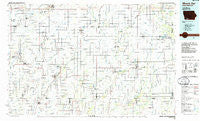
~ Mount Ayr IA topo map, 1:100000 scale, 30 X 60 Minute, Historical, 1985, updated 1985
Mount Ayr, Iowa, USGS topographic map dated 1985.
Includes geographic coordinates (latitude and longitude). This topographic map is suitable for hiking, camping, and exploring, or framing it as a wall map.
Printed on-demand using high resolution imagery, on heavy weight and acid free paper, or alternatively on a variety of synthetic materials.
Topos available on paper, Waterproof, Poly, or Tyvek. Usually shipping rolled, unless combined with other folded maps in one order.
- Product Number: USGS-5283717
- Free digital map download (high-resolution, GeoPDF): Mount Ayr, Iowa (file size: 14 MB)
- Map Size: please refer to the dimensions of the GeoPDF map above
- Weight (paper map): ca. 55 grams
- Map Type: POD USGS Topographic Map
- Map Series: HTMC
- Map Verison: Historical
- Cell ID: 67997
- Scan ID: 175210
- Imprint Year: 1985
- Woodland Tint: Yes
- Aerial Photo Year: 1984
- Edit Year: 1995
- Datum: NAD27
- Map Projection: Universal Transverse Mercator
- Planimetric: Yes
- Map published by United States Geological Survey
- Map Language: English
- Scanner Resolution: 600 dpi
- Map Cell Name: Mount Ayr
- Grid size: 30 X 60 Minute
- Date on map: 1985
- Map Scale: 1:100000
- Geographical region: Iowa, United States
Neighboring Maps:
All neighboring USGS topo maps are available for sale online at a variety of scales.
Spatial coverage:
Topo map Mount Ayr, Iowa, covers the geographical area associated the following places:
- Tingley - Watterson - Dayton (historical) - Benton - Guss - Blockton - Kent - Hatfield - Sheridan - Maloy - Allison - Mercer - New Market - Pawnee - Merle Junction - Ellston - Sharpsburg - Brooks - Villisca - Caledonia (historical) - Shepard (historical) - Athelstan - Irena - Arispe - Shannon City - Diagonal - Knowlton - Platteville - Ringgold (historical) - Lee (historical) - Beaconsfield - Kellerton - Bushville - Isadora - Nodaway - Lenox - Hopkins - Hawleyville - Corning - Mount Ayr - Bedford - Mortimer (historical) - Henshaw - Stringtown - Marshall (historical) - Wanamaker - Holt - Adams (historical) - Icarid (historical) - Polen - Gravity - Ladoga - Redding - Conway - Delphos - Clearfield - Siam - Iveyville - Iona City (historical)
- Map Area ID: AREA4140.5-95-94
- Northwest corner Lat/Long code: USGSNW41-95
- Northeast corner Lat/Long code: USGSNE41-94
- Southwest corner Lat/Long code: USGSSW40.5-95
- Southeast corner Lat/Long code: USGSSE40.5-94
- Northern map edge Latitude: 41
- Southern map edge Latitude: 40.5
- Western map edge Longitude: -95
- Eastern map edge Longitude: -94


