
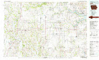
~ Leon IA topo map, 1:100000 scale, 30 X 60 Minute, Historical, 1981, updated 1982
Leon, Iowa, USGS topographic map dated 1981.
Includes geographic coordinates (latitude and longitude). This topographic map is suitable for hiking, camping, and exploring, or framing it as a wall map.
Printed on-demand using high resolution imagery, on heavy weight and acid free paper, or alternatively on a variety of synthetic materials.
Topos available on paper, Waterproof, Poly, or Tyvek. Usually shipping rolled, unless combined with other folded maps in one order.
- Product Number: USGS-5283707
- Free digital map download (high-resolution, GeoPDF): Leon, Iowa (file size: 18 MB)
- Map Size: please refer to the dimensions of the GeoPDF map above
- Weight (paper map): ca. 55 grams
- Map Type: POD USGS Topographic Map
- Map Series: HTMC
- Map Verison: Historical
- Cell ID: 67835
- Scan ID: 175005
- Imprint Year: 1982
- Woodland Tint: Yes
- Aerial Photo Year: 1978
- Edit Year: 1981
- Datum: NAD27
- Map Projection: Universal Transverse Mercator
- Map published by United States Geological Survey
- Map Language: English
- Scanner Resolution: 600 dpi
- Map Cell Name: Leon
- Grid size: 30 X 60 Minute
- Date on map: 1981
- Map Scale: 1:100000
- Geographical region: Iowa, United States
Neighboring Maps:
All neighboring USGS topo maps are available for sale online at a variety of scales.
Spatial coverage:
Topo map Leon, Iowa, covers the geographical area associated the following places:
- Morgan - Le Roy - Saxon - Terre Haute - Lineville - High Point - Adel - Leon - Derby - Melrose - Wataga - Mercer - Weldon - Woodland - Tuskeego - Green Bay (historical) - Saint John - Harvard - Clio - Van Wert - Powersville - Andover - Lacelle - Jerome - Allerton - Genoa - Hodge - Pleasanton - Cambria - Hopeville - Confidence - Ilia (historical) - Bridgeport - Sewal - Clinton Center - Brucewell - Cleopatra - South Lineville - Bethelhem - Ovia - Groveland (historical) - Garfield - Akron - Barrell - Wyreka - Galesburg - Plano - Last Chance - Big Spring (historical) - Decatur City - Smyrna - Millerton - Davis City - Leslie - Kingston - Russell - Promise City - Seymour - Zero - Burrows - Blockly - Togo (historical) - Peoria - Humeston - Garden Grove - New York - Corydon - New Buda - Saline - Grand River - Lamoni
- Map Area ID: AREA4140.5-94-93
- Northwest corner Lat/Long code: USGSNW41-94
- Northeast corner Lat/Long code: USGSNE41-93
- Southwest corner Lat/Long code: USGSSW40.5-94
- Southeast corner Lat/Long code: USGSSE40.5-93
- Northern map edge Latitude: 41
- Southern map edge Latitude: 40.5
- Western map edge Longitude: -94
- Eastern map edge Longitude: -93


