
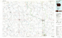
~ Humboldt IA topo map, 1:100000 scale, 30 X 60 Minute, Historical, 1984, updated 1985
Humboldt, Iowa, USGS topographic map dated 1984.
Includes geographic coordinates (latitude and longitude). This topographic map is suitable for hiking, camping, and exploring, or framing it as a wall map.
Printed on-demand using high resolution imagery, on heavy weight and acid free paper, or alternatively on a variety of synthetic materials.
Topos available on paper, Waterproof, Poly, or Tyvek. Usually shipping rolled, unless combined with other folded maps in one order.
- Product Number: USGS-5283683
- Free digital map download (high-resolution, GeoPDF): Humboldt, Iowa (file size: 12 MB)
- Map Size: please refer to the dimensions of the GeoPDF map above
- Weight (paper map): ca. 55 grams
- Map Type: POD USGS Topographic Map
- Map Series: HTMC
- Map Verison: Historical
- Cell ID: 67690
- Scan ID: 174840
- Imprint Year: 1985
- Woodland Tint: Yes
- Aerial Photo Year: 1983
- Edit Year: 1984
- Datum: NAD27
- Map Projection: Universal Transverse Mercator
- Planimetric: Yes
- Map published by United States Geological Survey
- Map Language: English
- Scanner Resolution: 600 dpi
- Map Cell Name: Humboldt
- Grid size: 30 X 60 Minute
- Date on map: 1984
- Map Scale: 1:100000
- Geographical region: Iowa, United States
Neighboring Maps:
All neighboring USGS topo maps are available for sale online at a variety of scales.
Spatial coverage:
Topo map Humboldt, Iowa, covers the geographical area associated the following places:
- Bode - Ware - Hanna - Vincent - Albert City - Manson - Westview - Palmer - Stein's Rockin R Mobile Home Park - Pomeroy - Bradgate - Pioneer - Rutland - Barnum - Clare - Ottosen - Saint Joseph - Ridotto - Rubens Siding - Rolfe - Varina - Unique - Lizard (historical) - Dakota City - Badger - Tara - Rusk - Fonda - Laurens - Marathon - Rolfe (historical) - Havelock - Pocahontas - Jones Siding - Thor - Gilmore City - Curlew - Leverett - Hardy - Humboldt - Arnold - Blanden - Galbraith - Mallard - West Bend - Plover - Livermore - Lu Verne - Knoke
- Map Area ID: AREA4342.5-95-94
- Northwest corner Lat/Long code: USGSNW43-95
- Northeast corner Lat/Long code: USGSNE43-94
- Southwest corner Lat/Long code: USGSSW42.5-95
- Southeast corner Lat/Long code: USGSSE42.5-94
- Northern map edge Latitude: 43
- Southern map edge Latitude: 42.5
- Western map edge Longitude: -95
- Eastern map edge Longitude: -94


