
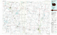
~ Estherville IA topo map, 1:100000 scale, 30 X 60 Minute, Historical, 1985, updated 1985
Estherville, Iowa, USGS topographic map dated 1985.
Includes geographic coordinates (latitude and longitude). This topographic map is suitable for hiking, camping, and exploring, or framing it as a wall map.
Printed on-demand using high resolution imagery, on heavy weight and acid free paper, or alternatively on a variety of synthetic materials.
Topos available on paper, Waterproof, Poly, or Tyvek. Usually shipping rolled, unless combined with other folded maps in one order.
- Product Number: USGS-5283669
- Free digital map download (high-resolution, GeoPDF): Estherville, Iowa (file size: 13 MB)
- Map Size: please refer to the dimensions of the GeoPDF map above
- Weight (paper map): ca. 55 grams
- Map Type: POD USGS Topographic Map
- Map Series: HTMC
- Map Verison: Historical
- Cell ID: 67487
- Scan ID: 174628
- Imprint Year: 1985
- Woodland Tint: Yes
- Aerial Photo Year: 1980
- Edit Year: 1985
- Datum: NAD27
- Map Projection: Universal Transverse Mercator
- Planimetric: Yes
- Map published by United States Geological Survey
- Map Language: English
- Scanner Resolution: 600 dpi
- Map Cell Name: Estherville
- Grid size: 30 X 60 Minute
- Date on map: 1985
- Map Scale: 1:100000
- Geographical region: Iowa, United States
Neighboring Maps:
All neighboring USGS topo maps are available for sale online at a variety of scales.
Spatial coverage:
Topo map Estherville, Iowa, covers the geographical area associated the following places:
- Terril - Osgood - Lotts Creek - Hobarton - Fairville - Lone Rock - Ringsted - Dolliver - Cylinder - Moores Siding (historical) - Bubona (historical) - Swea City - Fallow - Irvington - Huntington - German Valley - Graettinger - Stevens - Armstrong - Raleigh - Fenton - Sexton - Algona - Swea (historical) - Whittemore - Estherville - Hoprig - Rodman - Lakota - Forsyth - Ledyard - Saint Benedict - Ayrshire - Gruver - Seneca - Burt - Bancroft - Maple Hill - Ruthven - Superior - Gerled - Titonka - Gridley - Depew - Wallingford - Emmetsburg - Halfa
- Map Area ID: AREA43.543-95-94
- Northwest corner Lat/Long code: USGSNW43.5-95
- Northeast corner Lat/Long code: USGSNE43.5-94
- Southwest corner Lat/Long code: USGSSW43-95
- Southeast corner Lat/Long code: USGSSE43-94
- Northern map edge Latitude: 43.5
- Southern map edge Latitude: 43
- Western map edge Longitude: -95
- Eastern map edge Longitude: -94


