
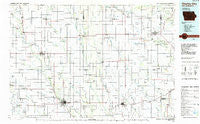
~ Charles City IA topo map, 1:100000 scale, 30 X 60 Minute, Historical, 1985, updated 1985
Charles City, Iowa, USGS topographic map dated 1985.
Includes geographic coordinates (latitude and longitude). This topographic map is suitable for hiking, camping, and exploring, or framing it as a wall map.
Printed on-demand using high resolution imagery, on heavy weight and acid free paper, or alternatively on a variety of synthetic materials.
Topos available on paper, Waterproof, Poly, or Tyvek. Usually shipping rolled, unless combined with other folded maps in one order.
- Product Number: USGS-5283643
- Free digital map download (high-resolution, GeoPDF): Charles City, Iowa (file size: 13 MB)
- Map Size: please refer to the dimensions of the GeoPDF map above
- Weight (paper map): ca. 55 grams
- Map Type: POD USGS Topographic Map
- Map Series: HTMC
- Map Verison: Historical
- Cell ID: 67270
- Scan ID: 174296
- Imprint Year: 1985
- Woodland Tint: Yes
- Aerial Photo Year: 1983
- Edit Year: 1985
- Datum: NAD27
- Map Projection: Universal Transverse Mercator
- Planimetric: Yes
- Map published by United States Geological Survey
- Map Language: English
- Scanner Resolution: 600 dpi
- Map Cell Name: Charles City
- Grid size: 30 X 60 Minute
- Date on map: 1985
- Map Scale: 1:100000
- Geographical region: Iowa, United States
Neighboring Maps:
All neighboring USGS topo maps are available for sale online at a variety of scales.
Spatial coverage:
Topo map Charles City, Iowa, covers the geographical area associated the following places:
- Cresco - New Hampton - McIntire - Lourdes - Stacyville - Rudd - Elma - Brownville - North Washington - Protivin - Charles City - Devon - Navan - Mona - Midway - Lime Springs - Osage - Chickasaw - Davis Corners - Saude - Jacksonville - Nansen - Little Turkey - Bethany Hall - Vernon Springs - Lowther Station (historical) - Greenfield Park Mobile Home Court - Howardville - Floyd Crossing - Rockford - Saint Ansgar - Rock Creek - Kendallville - Deerfield - Dixie - Ionia - Jackson Junction - Otranto - Reilly Settlement - Carney - Toeterville - Schley - Oakwood - Carrville - New Haven - Alta Vista - Roseville - Meyer - Lidtke Mill - Boyd - Waucoma - Chester - Riceville (historical) - Lawler - Stacyville Junction - Floyd - Florenceville - Little Cedar - Orchard - Doubleday - Bailey - Maple Leaf - Jerico - Nilesville - Bonair - Colwell - Forest City (historical) - Mitchell - Riceville - Bassett - Saratoga
- Map Area ID: AREA43.543-93-92
- Northwest corner Lat/Long code: USGSNW43.5-93
- Northeast corner Lat/Long code: USGSNE43.5-92
- Southwest corner Lat/Long code: USGSSW43-93
- Southeast corner Lat/Long code: USGSSE43-92
- Northern map edge Latitude: 43.5
- Southern map edge Latitude: 43
- Western map edge Longitude: -93
- Eastern map edge Longitude: -92


