
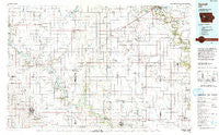
~ Carroll IA topo map, 1:100000 scale, 30 X 60 Minute, Historical, 1993, updated 1993
Carroll, Iowa, USGS topographic map dated 1993.
Includes geographic coordinates (latitude and longitude). This topographic map is suitable for hiking, camping, and exploring, or framing it as a wall map.
Printed on-demand using high resolution imagery, on heavy weight and acid free paper, or alternatively on a variety of synthetic materials.
Topos available on paper, Waterproof, Poly, or Tyvek. Usually shipping rolled, unless combined with other folded maps in one order.
- Product Number: USGS-5283639
- Free digital map download (high-resolution, GeoPDF): Carroll, Iowa (file size: 16 MB)
- Map Size: please refer to the dimensions of the GeoPDF map above
- Weight (paper map): ca. 55 grams
- Map Type: POD USGS Topographic Map
- Map Series: HTMC
- Map Verison: Historical
- Cell ID: 67243
- Scan ID: 174247
- Imprint Year: 1993
- Woodland Tint: Yes
- Aerial Photo Year: 1991
- Edit Year: 1993
- Datum: NAD27
- Map Projection: Universal Transverse Mercator
- Map published by United States Geological Survey
- Map Language: English
- Scanner Resolution: 600 dpi
- Map Cell Name: Carroll
- Grid size: 30 X 60 Minute
- Date on map: 1993
- Map Scale: 1:100000
- Geographical region: Iowa, United States
Neighboring Maps:
All neighboring USGS topo maps are available for sale online at a variety of scales.
Spatial coverage:
Topo map Carroll, Iowa, covers the geographical area associated the following places:
- Ulmer - Mount Carmel - Scranton - Churdan - Paton - Breda - Grant City - Palm Grove - Pettis - Easley - Maple River - Harcourt - Dana - Slifer - Twin Lakes - Evanston - Carroll - Rockwell City - Lanesboro - Lanyon - Lytton - Wightman - Gowrie - Sac City - Farnhamville - Shady Oak - Twin Lakes Trailer Court - Carroll Community Estates - Judd - Lavinia - Roselle - Lehigh - Sherwood - Somers - Lundgren - Jefferson - Fort Dodge - West Fort Dodge (historical) - Glidden - Kalo - Grand Junction - Roelyn - Ogden - Brushy - M and S Mobile Home Park - Cypsum City (historical) - Benan (historical) - Halbur - Knierim - Auburn - Roberts - Rinard - Lena - Border Plains - Burnside - Gravel Pit - Rands - Ralston - Otho - Stimsons (historical) - Richard - Beaver - Wolf - Lidderdale - Yetter - Kentner - Lake City - Coalville - Moorland - Hart - Callender - Dayton - Wadleigh - Boxholm - Adaza - Farlin - Lohrville - Jolley - Pilot Mound - Piper
- Map Area ID: AREA42.542-95-94
- Northwest corner Lat/Long code: USGSNW42.5-95
- Northeast corner Lat/Long code: USGSNE42.5-94
- Southwest corner Lat/Long code: USGSSW42-95
- Southeast corner Lat/Long code: USGSSE42-94
- Northern map edge Latitude: 42.5
- Southern map edge Latitude: 42
- Western map edge Longitude: -95
- Eastern map edge Longitude: -94


