
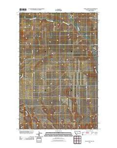
~ Wolf Point NE MT topo map, 1:24000 scale, 7.5 X 7.5 Minute, Historical, 2011
Wolf Point NE, Montana, USGS topographic map dated 2011.
Includes geographic coordinates (latitude and longitude). This topographic map is suitable for hiking, camping, and exploring, or framing it as a wall map.
Printed on-demand using high resolution imagery, on heavy weight and acid free paper, or alternatively on a variety of synthetic materials.
Topos available on paper, Waterproof, Poly, or Tyvek. Usually shipping rolled, unless combined with other folded maps in one order.
- Product Number: USGS-5280491
- Free digital map download (high-resolution, GeoPDF): Wolf Point NE, Montana (file size: 10 MB)
- Map Size: please refer to the dimensions of the GeoPDF map above
- Weight (paper map): ca. 55 grams
- Map Type: POD USGS Topographic Map
- Map Series: US Topo
- Map Verison: Historical
- Cell ID: 49676
- Datum: North American Datum of 1983
- Map Projection: Transverse Mercator
- Map Cell Name: Wolf Point NE
- Grid size: 7.5 X 7.5 Minute
- Date on map: 2011
- Map Scale: 1:24000
- Geographical region: Montana, United States
Neighboring Maps:
All neighboring USGS topo maps are available for sale online at a variety of scales.
Spatial coverage:
Topo map Wolf Point NE, Montana, covers the geographical area associated the following places:
- 28N48E04AACC01 Well - 28N48E32BC__01 Well - 28N48E03DD__03 Well - Marquardt School (historical) - 29N47E26BDCA01 Spring - 28N48E18AD__03 Well - 28N48E32BC__02 Well - 28N48E03DD__02 Well - 28N48E28AADD01 Spring - 28N48E03DA__01 Well - 28N48E31AB__02 Well - 28N48E28BBDB01 Spring - 28N48E03DD__01 Well - West Fork Tule Creek - 28N48E28CCDC01 Spring - 28N48E30DCCD01 Spring - 28N48E21DD__01 Well - 28N48E18AD__01 Well - 28N48E08BBBA01 Well - 28N48E08BB__01 Well - 29N47E26ACBA01 Well - 28N48E34AC__01 Well - 28N47E26DBAD01 Well - 28N48E21CD__01 Well - 28N48E30AD__01 Well - 28N48E28BABB01 Well - 28N48E17BA__01 Well - 28N48E28BBBD01 Spring - 28N48E20AA__01 Well - 28N47E35DCBA01 Well - 28N48E09DDCC01 Spring - 28N48E08BCCC01 Well - 28N47E26DBAD02 Well - 28N48E18AD__02 Well - 29N47E28AAAA01 Well - 28N47E02CBBD01 Well - 28N48E03DDBB01 Well - 28N48E30ACCC01 Spring - 28N48E28BABC01 Well - 28N48E03AC__01 Well - 28N48E03AC__02 Well - 28N48E31AB__01 Well
- Map Area ID: AREA48.2548.125-105.625-105.5
- Northwest corner Lat/Long code: USGSNW48.25-105.625
- Northeast corner Lat/Long code: USGSNE48.25-105.5
- Southwest corner Lat/Long code: USGSSW48.125-105.625
- Southeast corner Lat/Long code: USGSSE48.125-105.5
- Northern map edge Latitude: 48.25
- Southern map edge Latitude: 48.125
- Western map edge Longitude: -105.625
- Eastern map edge Longitude: -105.5


