
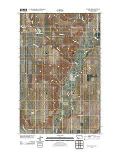
~ Badger Creek MT topo map, 1:24000 scale, 7.5 X 7.5 Minute, Historical, 2011
Badger Creek, Montana, USGS topographic map dated 2011.
Includes geographic coordinates (latitude and longitude). This topographic map is suitable for hiking, camping, and exploring, or framing it as a wall map.
Printed on-demand using high resolution imagery, on heavy weight and acid free paper, or alternatively on a variety of synthetic materials.
Topos available on paper, Waterproof, Poly, or Tyvek. Usually shipping rolled, unless combined with other folded maps in one order.
- Product Number: USGS-5280403
- Free digital map download (high-resolution, GeoPDF): Badger Creek, Montana (file size: 10 MB)
- Map Size: please refer to the dimensions of the GeoPDF map above
- Weight (paper map): ca. 55 grams
- Map Type: POD USGS Topographic Map
- Map Series: US Topo
- Map Verison: Historical
- Cell ID: 2079
- Datum: North American Datum of 1983
- Map Projection: Transverse Mercator
- Map Cell Name: Badger Creek
- Grid size: 7.5 X 7.5 Minute
- Date on map: 2011
- Map Scale: 1:24000
- Geographical region: Montana, United States
Neighboring Maps:
All neighboring USGS topo maps are available for sale online at a variety of scales.
Spatial coverage:
Topo map Badger Creek, Montana, covers the geographical area associated the following places:
- 28N51E08CCBC02 Well - 28N51E17DADA01 Well - 28N50E36DDCA01 Well - 28N50E35CD__01 Well - 28N51E29BACA01 Well - 28N51E17AABA01 Well - 28N50E25DDDA01 Well - Poplar Municipal Airport - Structure Number 137 Dam - 28N51E21BDBC01 Well - Little Badger Spring - 28N51E32CCCB01 Well - 28N51E16DBCB01 Well - 28N51E17ABDD01 Well - 28N50E36AAAA02 Well - Barney Rubbel Dam - 28N51E29CACB01 Well - 29N51E19DCAC01 Well - 29N51E31BDBA01 Well - 27N50E03AD__02 Well - 29N51E31CABB01 Well - 28N51E33DDCC04 Well - 28N51E09CDBB01 Well - Crandall Reservoir - 28N51E33DDCC03 Well - 28N51E09CCDD01 Well - 28N51E32DCCC01 Well - 28N51E18ABDC01 Well - 28N51E08CCBC01 Well - 29N51E31DBDD01 Well - 28N51E08BACC01 Well - 28N51E33DDCC05 Well - 28N51E33DDCC02 Well - 28N50E36DD__01 Well - 28N51E08BBDB01 Well - 29N51E31ABDD01 Well - 28N51E17DDAD01 Well - 28N51E22CBCB01 Well - 28N51E17ADAD01 Well - 28N51E09BCBB01 Well - 27N50E02BB__01 Well - 28N51E33DDCC01 Well - 29N51E30DDDD01 Spring - Clark Pond Number 2 Dam - 28N51E08BBDA01 Well - 28N51E27BBBB01 Well - Culbertson Creek - 28N51E22BBBB01 Well - 28N51E19AB__01 Well - 28N51E17ABDC01 Well - 29N51E19DDBA01 Spring - 28N51E08DDDB01 Well - Structure Number 139 Reservoir - 28N51E08AAAC01 Well - 28N51E33BBBC02 Well - 29N51E31DBAD01 Well - 28N50E26DC__01 Well - 28N51E22CBCB02 Well - 28N51E04CCCD01 Well - 28N50E34DCAC01 Well - 28N51E33BBBC01 Well - 29N50E33DDCC01 Spring - Little Badger Creek - 27N50E03AA__01 Well - 28N50E02AD__01 Well - 28N51E08BACC02 Well - 28N51E08CCBB01 Well - 28N51E08ADDA01 Well - 28N51E08BDBA02 Well - Flea Creek - 28N51E08BDBA01 Well - 27N50E03AD__01 Well - 28N51E17AABB01 Well - 28N51E09DCCC01 Well - 28N51E33BBBB01 Well - 28N50E12AB__01 Well - 28N50E36AAAA01 Well - 28N51E17ABDC02 Well - Badger Creek - 28N51E17ABDD02 Well - 28N51E33CBAA01 Well - Crandall Reservoir Dam
- Map Area ID: AREA48.2548.125-105.25-105.125
- Northwest corner Lat/Long code: USGSNW48.25-105.25
- Northeast corner Lat/Long code: USGSNE48.25-105.125
- Southwest corner Lat/Long code: USGSSW48.125-105.25
- Southeast corner Lat/Long code: USGSSE48.125-105.125
- Northern map edge Latitude: 48.25
- Southern map edge Latitude: 48.125
- Western map edge Longitude: -105.25
- Eastern map edge Longitude: -105.125


