
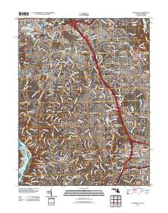
~ Rockville MD topo map, 1:24000 scale, 7.5 X 7.5 Minute, Historical, 2011
Rockville, Maryland, USGS topographic map dated 2011.
Includes geographic coordinates (latitude and longitude). This topographic map is suitable for hiking, camping, and exploring, or framing it as a wall map.
Printed on-demand using high resolution imagery, on heavy weight and acid free paper, or alternatively on a variety of synthetic materials.
Topos available on paper, Waterproof, Poly, or Tyvek. Usually shipping rolled, unless combined with other folded maps in one order.
- Product Number: USGS-5279640
- Free digital map download (high-resolution, GeoPDF): Rockville, Maryland (file size: 26 MB)
- Map Size: please refer to the dimensions of the GeoPDF map above
- Weight (paper map): ca. 55 grams
- Map Type: POD USGS Topographic Map
- Map Series: US Topo
- Map Verison: Historical
- Cell ID: 38338
- Datum: North American Datum of 1983
- Map Projection: Transverse Mercator
- Map Cell Name: Rockville
- Grid size: 7.5 X 7.5 Minute
- Date on map: 2011
- Map Scale: 1:24000
- Geographical region: Maryland, United States
Neighboring Maps:
All neighboring USGS topo maps are available for sale online at a variety of scales.
Spatial coverage:
Topo map Rockville, Maryland, covers the geographical area associated the following places:
- Silver Rock - Rockcrest - Rockville - Deerfield - Knollwood - Wildwood Hills - Westmore - Tilden Woods - Regency Estates - Montrose - Willerburn Acres - Lake Normandy Estates - Green Tree Manor - Derwood - Potomac Woods - Big Pines - Old Georgetown Estates - Inverness Knolls - Bells Mill - Heritage Walk - Charred Oak Estates - Glen Hills - Glenora Hills - Needwood Estates - Bradley Farms - Campbell Corner - Potomac Glen - Hungerford Towne - Croydon Park - Lakewood Estates - Rose Hill Estates - Rollins Park - Hunting Hill - Washingtonian Woods - Ashleigh - Lelands Corner - Williamsburg Estates - Holly Hill - The Willows of Potomac - Beantown - Longwood - Beverly Farms - McAuley Park - Potomac Manors - Great Falls - Walnut Woods - Stonebridge - Stratton Woods - Marymount - Fallsgrove - Falls Orchard - Old Farm - Potomac Falls - Glen - Fox Hills - Georgetown Village - West End Park - Burning Tree Estates - Scotland - Potomac - Woodley Gardens - Pine Knolls - North Farm - Rockland - Ashburton - Potomac Hunt Acres - Bradley Hills Grove - Fernwood - Montgomery Square - Hollinridge
- Map Area ID: AREA39.12539-77.25-77.125
- Northwest corner Lat/Long code: USGSNW39.125-77.25
- Northeast corner Lat/Long code: USGSNE39.125-77.125
- Southwest corner Lat/Long code: USGSSW39-77.25
- Southeast corner Lat/Long code: USGSSE39-77.125
- Northern map edge Latitude: 39.125
- Southern map edge Latitude: 39
- Western map edge Longitude: -77.25
- Eastern map edge Longitude: -77.125


