
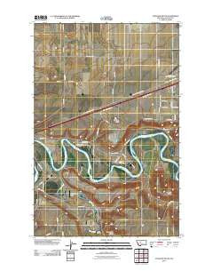
~ Antelope Butte MT topo map, 1:24000 scale, 7.5 X 7.5 Minute, Historical, 2011
Antelope Butte, Montana, USGS topographic map dated 2011.
Includes geographic coordinates (latitude and longitude). This topographic map is suitable for hiking, camping, and exploring, or framing it as a wall map.
Printed on-demand using high resolution imagery, on heavy weight and acid free paper, or alternatively on a variety of synthetic materials.
Topos available on paper, Waterproof, Poly, or Tyvek. Usually shipping rolled, unless combined with other folded maps in one order.
- Product Number: USGS-5279056
- Free digital map download (high-resolution, GeoPDF): Antelope Butte, Montana (file size: 10 MB)
- Map Size: please refer to the dimensions of the GeoPDF map above
- Weight (paper map): ca. 55 grams
- Map Type: POD USGS Topographic Map
- Map Series: US Topo
- Map Verison: Historical
- Cell ID: 1109
- Datum: North American Datum of 1983
- Map Projection: Transverse Mercator
- Map Cell Name: Antelope Butte
- Grid size: 7.5 X 7.5 Minute
- Date on map: 2011
- Map Scale: 1:24000
- Geographical region: Montana, United States
Neighboring Maps:
All neighboring USGS topo maps are available for sale online at a variety of scales.
Spatial coverage:
Topo map Antelope Butte, Montana, covers the geographical area associated the following places:
- 20N02E22C___02 Well - 20N04E16CCBA02 Well - 19N02E01BCBC01 Well - 20N02E25C___01 Well - 20N02E23A___01 Well - 20N02E24B___01 Well - 20N02E34A___01 Well - Wilson Butte - Sun River Bench School (historical) - Lord Coulee - 20N03E08DCBB01 Well - 20N02E28____02 Well - 19N02E21D___01 Well - Sun River Historical Marker (historical) - 20N02E28____01 Well - 20N02E15____01 Well - 20N02E33B___02 Well - 20N02E28A___01 Well - 20N03E29ACBA01 Well - Ferguson School (historical) - Sun River Bench - 20N03E17C___01 Well - 20N02E35D___01 Well - 20N02E22____01 Well - 20N02E13____01 Well - 20N02E22C___01 Well - 19N03E05BABA01 Well - Smith Farms Airport - 20N02E22C___03 Well - Buchanan Ranch Airport (historical) - Lower Smith River Fishing Access Site - Ulm Bridge Fishing Access Site - Smith River - Antelope Butte - 20N03E32DBAB01 Well - 20N03E29ADCC01 Well - 20N02E33B___01 Well - Great Falls Division - 19N02E23C___01 Well - 20N02E15A___01 Well - 20N03E30A___01 Well - 20N02E22C___04 Well - 20N02E22D___01 Well - Bair Airport - 20N02E15D___01 Well - 20N02E21____01 Well - 20N02E23C___01 Well - 19N02E08DDDD01 Well
- Map Area ID: AREA47.547.375-111.5-111.375
- Northwest corner Lat/Long code: USGSNW47.5-111.5
- Northeast corner Lat/Long code: USGSNE47.5-111.375
- Southwest corner Lat/Long code: USGSSW47.375-111.5
- Southeast corner Lat/Long code: USGSSE47.375-111.375
- Northern map edge Latitude: 47.5
- Southern map edge Latitude: 47.375
- Western map edge Longitude: -111.5
- Eastern map edge Longitude: -111.375


