
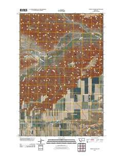
~ Strouf Island MT topo map, 1:24000 scale, 7.5 X 7.5 Minute, Historical, 2011
Strouf Island, Montana, USGS topographic map dated 2011.
Includes geographic coordinates (latitude and longitude). This topographic map is suitable for hiking, camping, and exploring, or framing it as a wall map.
Printed on-demand using high resolution imagery, on heavy weight and acid free paper, or alternatively on a variety of synthetic materials.
Topos available on paper, Waterproof, Poly, or Tyvek. Usually shipping rolled, unless combined with other folded maps in one order.
- Product Number: USGS-5279054
- Free digital map download (high-resolution, GeoPDF): Strouf Island, Montana (file size: 14 MB)
- Map Size: please refer to the dimensions of the GeoPDF map above
- Weight (paper map): ca. 55 grams
- Map Type: POD USGS Topographic Map
- Map Series: US Topo
- Map Verison: Historical
- Cell ID: 43524
- Datum: North American Datum of 1983
- Map Projection: Transverse Mercator
- Map Cell Name: Strouf Island
- Grid size: 7.5 X 7.5 Minute
- Date on map: 2011
- Map Scale: 1:24000
- Geographical region: Montana, United States
Neighboring Maps:
All neighboring USGS topo maps are available for sale online at a variety of scales.
Spatial coverage:
Topo map Strouf Island, Montana, covers the geographical area associated the following places:
- 20N13E25BAAA01 Well - Big Coulee - 19N13E22BAC_01 Well - 19N13E29BABB01 Well - 19N13E22BBDA01 Well - Cafe Mocha Dam - 19N13E29BCBD01 Well - 19N13E12CDC_01 Well - Arrow Creek Bench - Cowboy Creek - Coffee Mate Dam - White Arrow School (historical) - Butte Creek - 19N13E01DA__01 Well - 19N14E07BCB_01 Well - 19N13E29BCCC01 Well - 20N13E26AAD_01 Well - 19N13E29AAAA01 Well - 20N13E20CACA01 Well - 20N13E27ABC_01 Well - 19N13E29BCAA01 Well - Strouf Island - Dieanira Dam
- Map Area ID: AREA47.547.375-110.125-110
- Northwest corner Lat/Long code: USGSNW47.5-110.125
- Northeast corner Lat/Long code: USGSNE47.5-110
- Southwest corner Lat/Long code: USGSSW47.375-110.125
- Southeast corner Lat/Long code: USGSSE47.375-110
- Northern map edge Latitude: 47.5
- Southern map edge Latitude: 47.375
- Western map edge Longitude: -110.125
- Eastern map edge Longitude: -110


