
~ New Freedom PA topo map, 1:24000 scale, 7.5 X 7.5 Minute, Historical, 2011
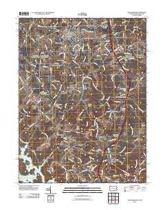
New Freedom, Pennsylvania, USGS topographic map dated 2011.
Includes geographic coordinates (latitude and longitude). This topographic map is suitable for hiking, camping, and exploring, or framing it as a wall map.
Printed on-demand using high resolution imagery, on heavy weight and acid free paper, or alternatively on a variety of synthetic materials.
Topos available on paper, Waterproof, Poly, or Tyvek. Usually shipping rolled, unless combined with other folded maps in one order.
- Product Number: USGS-5276252
- Free digital map download (high-resolution, GeoPDF): New Freedom, Pennsylvania (file size: 20 MB)
- Map Size: please refer to the dimensions of the GeoPDF map above
- Weight (paper map): ca. 55 grams
- Map Type: POD USGS Topographic Map
- Map Series: US Topo
- Map Verison: Historical
- Cell ID: 31712
- Datum: North American Datum of 1983
- Map Projection: Transverse Mercator
- Map Cell Name: New Freedom
- Grid size: 7.5 X 7.5 Minute
- Date on map: 2011
- Map Scale: 1:24000
- Geographical region: Pennsylvania, United States
Neighboring Maps:
All neighboring USGS topo maps are available for sale online at a variety of scales.
Spatial coverage:
Topo map New Freedom, Pennsylvania, covers the geographical area associated the following places:
- Ruhl - Maryland Line - Walker Manor - Linden Springs - New Freedom - Sunset View - Parkton - Spook Hill - Harris Hill - Beetree - Freeland - Pen Delle Manor - Huntridge North - Windtree Valley - Stablers Manor - Oaks of Parsonage - Hamlet Farms - Rayville - Dairy Manor Farms - Shamburg (historical) - Graystone - Five Forks - Grimesville - Brook Valley Farms - Walker - Keener (historical) - Valley Mill - Chalet De La Rance - Coachmans Field - Bentley Springs - Bentley Estates - Green Meadow - Freeland Farms - Spring Valley Farms - Dar - Gores Mill - Oakland - Beetree Manor - Bentley Hills - Keeney Mill Farms - Valley Mill Farms - Eklo - Keeney Mill Woods
- Map Area ID: AREA39.7539.625-76.75-76.625
- Northwest corner Lat/Long code: USGSNW39.75-76.75
- Northeast corner Lat/Long code: USGSNE39.75-76.625
- Southwest corner Lat/Long code: USGSSW39.625-76.75
- Southeast corner Lat/Long code: USGSSE39.625-76.625
- Northern map edge Latitude: 39.75
- Southern map edge Latitude: 39.625
- Western map edge Longitude: -76.75
- Eastern map edge Longitude: -76.625


