
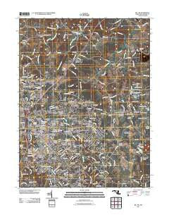
~ Bel Air MD topo map, 1:24000 scale, 7.5 X 7.5 Minute, Historical, 2011
Bel Air, Maryland, USGS topographic map dated 2011.
Includes geographic coordinates (latitude and longitude). This topographic map is suitable for hiking, camping, and exploring, or framing it as a wall map.
Printed on-demand using high resolution imagery, on heavy weight and acid free paper, or alternatively on a variety of synthetic materials.
Topos available on paper, Waterproof, Poly, or Tyvek. Usually shipping rolled, unless combined with other folded maps in one order.
- Product Number: USGS-5276238
- Free digital map download (high-resolution, GeoPDF): Bel Air, Maryland (file size: 22 MB)
- Map Size: please refer to the dimensions of the GeoPDF map above
- Weight (paper map): ca. 55 grams
- Map Type: POD USGS Topographic Map
- Map Series: US Topo
- Map Verison: Historical
- Cell ID: 3084
- Datum: North American Datum of 1983
- Map Projection: Transverse Mercator
- Map Cell Name: Bel Air
- Grid size: 7.5 X 7.5 Minute
- Date on map: 2011
- Map Scale: 1:24000
- Geographical region: Maryland, United States
Neighboring Maps:
All neighboring USGS topo maps are available for sale online at a variety of scales.
Spatial coverage:
Topo map Bel Air, Maryland, covers the geographical area associated the following places:
- Hickory - Pegasus Estates - Marywood - Mechanicsville (historical) - Hickory Village Mobile Home Park - Old Dixie Manor - Moores Mill - Homestead Village - Allendale Estates - Foxborough Farms - Harford Village - Harford Ranchettes - Upper Crest Estates - Harold Heights - Joppa Hills - Bramblewood - English Country Manor - Tudor Forest - Glenwood - Kalmia - Country Village - Stoneleigh - Moorland - Chestnut Hill - Hillview - Camelot - Martindale - Cool Spring - Fountain Green Mobile Home Park - Bynum - Hill-N-Dale - Fountain Green - Watervale - Todd Lakes - Priestford Hills - Morgan Park - Corns Manor - Heritage Woods - Lyns Rest - Scots Fancy - Woodside - Harford Hills - South Bel Air - Harlan Square - Gibson - Majors Choice - Hickory Hills - Deercreek (historical) - Southampton - Deerhaven - Campus Hill Farms - Bradford Village - Old Fields - Campus Hills Estates - Brentwood Park - Calvary - Meadow Springs - Grose Close - Michaels Corner - Fountain Glen - Thomas Run - Bright Oaks - Michaels Meadows - Cedar Spring - Hemlock Ridge - Fairmont - Harford Woods - Green Ridge - Shucks Corners - Fountain Green Heights - Pheasant Ridge - Knollwood - Todd Estates - Evergreen Heights - Tollgate Estates - Oak Dale - Fountain Green Estates - Friendship Heights - White Oak - Big Woods - Warwick - Glenwood Garth - Hampton Ridge - Allibone (historical) - Northridge - Chatham - Wakefield Meadows - Eagle Estates - Glengate - Gibson Manor - Fairwood Heights - Locust Knoll - Wakely Terrace - Grafton Heights - Roland Place - Greenbrier Hills - North Bel Air - Brierwood - Creswell - Drexel
- Map Area ID: AREA39.62539.5-76.375-76.25
- Northwest corner Lat/Long code: USGSNW39.625-76.375
- Northeast corner Lat/Long code: USGSNE39.625-76.25
- Southwest corner Lat/Long code: USGSSW39.5-76.375
- Southeast corner Lat/Long code: USGSSE39.5-76.25
- Northern map edge Latitude: 39.625
- Southern map edge Latitude: 39.5
- Western map edge Longitude: -76.375
- Eastern map edge Longitude: -76.25


