
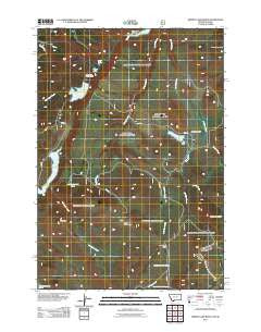
~ Hidden Lake Bench MT topo map, 1:24000 scale, 7.5 X 7.5 Minute, Historical, 2011
Hidden Lake Bench, Montana, USGS topographic map dated 2011.
Includes geographic coordinates (latitude and longitude). This topographic map is suitable for hiking, camping, and exploring, or framing it as a wall map.
Printed on-demand using high resolution imagery, on heavy weight and acid free paper, or alternatively on a variety of synthetic materials.
Topos available on paper, Waterproof, Poly, or Tyvek. Usually shipping rolled, unless combined with other folded maps in one order.
- Product Number: USGS-5272338
- Free digital map download (high-resolution, GeoPDF): Hidden Lake Bench, Montana (file size: 15 MB)
- Map Size: please refer to the dimensions of the GeoPDF map above
- Weight (paper map): ca. 55 grams
- Map Type: POD USGS Topographic Map
- Map Series: US Topo
- Map Verison: Historical
- Cell ID: 20327
- Datum: North American Datum of 1983
- Map Projection: Transverse Mercator
- Map Cell Name: Hidden Lake Bench
- Grid size: 7.5 X 7.5 Minute
- Date on map: 2011
- Map Scale: 1:24000
- Geographical region: Montana, United States
Neighboring Maps:
All neighboring USGS topo maps are available for sale online at a variety of scales.
Spatial coverage:
Topo map Hidden Lake Bench, Montana, covers the geographical area associated the following places:
- Goose Lake - Brimstone Creek - Horn Mountains - 13S01E28AACD01 Spring - Conklin Lake - Saddle Mountain - Elk Mountain - Lone Tree Pass - Hidden Lake Camp Ground - Elk Lake - 14S02E07CBAD01 Spring - Lost Spring - 13S01E36DDD_01 Spring - 13S01E33AAC_01 Spring - Otter Lake - Orr Ranch - Hidden Lake Bench - Antelope Basin - Anthill Creek - Lone Tree Creek - Limestone Creek - Poison Creek - Deer Mountain - Spring Branch - Hidden Lake - Lost Mine Canyon - Antelope Creek - 14S02E06CCCB01 Spring
- Map Area ID: AREA44.7544.625-111.625-111.5
- Northwest corner Lat/Long code: USGSNW44.75-111.625
- Northeast corner Lat/Long code: USGSNE44.75-111.5
- Southwest corner Lat/Long code: USGSSW44.625-111.625
- Southeast corner Lat/Long code: USGSSE44.625-111.5
- Northern map edge Latitude: 44.75
- Southern map edge Latitude: 44.625
- Western map edge Longitude: -111.625
- Eastern map edge Longitude: -111.5


