
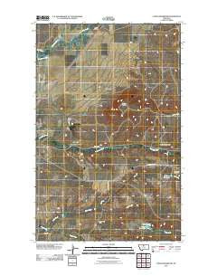
~ Cowan Reservoir MT topo map, 1:24000 scale, 7.5 X 7.5 Minute, Historical, 2011
Cowan Reservoir, Montana, USGS topographic map dated 2011.
Includes geographic coordinates (latitude and longitude). This topographic map is suitable for hiking, camping, and exploring, or framing it as a wall map.
Printed on-demand using high resolution imagery, on heavy weight and acid free paper, or alternatively on a variety of synthetic materials.
Topos available on paper, Waterproof, Poly, or Tyvek. Usually shipping rolled, unless combined with other folded maps in one order.
- Product Number: USGS-5272186
- Free digital map download (high-resolution, GeoPDF): Cowan Reservoir, Montana (file size: 12 MB)
- Map Size: please refer to the dimensions of the GeoPDF map above
- Weight (paper map): ca. 55 grams
- Map Type: POD USGS Topographic Map
- Map Series: US Topo
- Map Verison: Historical
- Cell ID: 10443
- Datum: North American Datum of 1983
- Map Projection: Transverse Mercator
- Map Cell Name: Cowan Reservoir
- Grid size: 7.5 X 7.5 Minute
- Date on map: 2011
- Map Scale: 1:24000
- Geographical region: Montana, United States
Neighboring Maps:
All neighboring USGS topo maps are available for sale online at a variety of scales.
Spatial coverage:
Topo map Cowan Reservoir, Montana, covers the geographical area associated the following places:
- Deucalton Dam - Brown Dam - Rocky Boy West Census Designated Place - Filbert (historical) - Brown Dam - Tow Dam - Sage Creek - Dry Fork - 30N14E17BA__01 Well - Ugly Dam - Camp Creek - Sand Coulee - Didache Dam - Cowan Reservoir Dam - Square Butte - Dry Fork Reservoir - Peephole Dam - 30N14E08BD__01 Well - Cowan Reservoir
- Map Area ID: AREA48.37548.25-110-109.875
- Northwest corner Lat/Long code: USGSNW48.375-110
- Northeast corner Lat/Long code: USGSNE48.375-109.875
- Southwest corner Lat/Long code: USGSSW48.25-110
- Southeast corner Lat/Long code: USGSSE48.25-109.875
- Northern map edge Latitude: 48.375
- Southern map edge Latitude: 48.25
- Western map edge Longitude: -110
- Eastern map edge Longitude: -109.875


