
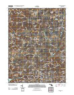
~ Phoenix MD topo map, 1:24000 scale, 7.5 X 7.5 Minute, Historical, 2011
Phoenix, Maryland, USGS topographic map dated 2011.
Includes geographic coordinates (latitude and longitude). This topographic map is suitable for hiking, camping, and exploring, or framing it as a wall map.
Printed on-demand using high resolution imagery, on heavy weight and acid free paper, or alternatively on a variety of synthetic materials.
Topos available on paper, Waterproof, Poly, or Tyvek. Usually shipping rolled, unless combined with other folded maps in one order.
- Product Number: USGS-5271810
- Free digital map download (high-resolution, GeoPDF): Phoenix, Maryland (file size: 19 MB)
- Map Size: please refer to the dimensions of the GeoPDF map above
- Weight (paper map): ca. 55 grams
- Map Type: POD USGS Topographic Map
- Map Series: US Topo
- Map Verison: Historical
- Cell ID: 34991
- Datum: North American Datum of 1983
- Map Projection: Transverse Mercator
- Map Cell Name: Phoenix
- Grid size: 7.5 X 7.5 Minute
- Date on map: 2011
- Map Scale: 1:24000
- Geographical region: Maryland, United States
Neighboring Maps:
All neighboring USGS topo maps are available for sale online at a variety of scales.
Spatial coverage:
Topo map Phoenix, Maryland, covers the geographical area associated the following places:
- Blackhorse - Sweet Air Manor - Jackson Ridge - Sunnybrook - Greenfield - Wetherbee - Stockton Woods - My Ladys Manor Estates - Manor Glade - Fox Meadows Purchase - Millgate - Glen Elyn - Carroll Manor Ridge - Vance Valley - Sutton Manor - Monkton - Hunters Mill - Corbett - Monkton Farms - Pleasant Prospect at Glen Elyn - Shepperd - Charbonnet - Brookfield - Manor View Farms - Fairwood of Hunt Valley - Fox Meadows Woods - Troyer - Fern Valley - Manor Fields - Manor Glen - Houcks Mill - Fox Meadows - Hunt Crest - Foxwood - Dulaney Valley Estates - Blenheim Forest - Hurline Farms - The Highlands of Hunt Valley - Locksley - Manor Brook - Merrymans Mill - Corbett Hill Farms - Hess - Henrys Bridge - Old York Manor - Cross Creek - Cool Meadows Farms - Manor Ridge - Kinhart Manor - Ascot Estates - Mission Ridge - Taylor - Hampshire - Stockton - Manor - Phoenix - Cooperfield - Wooddale Farms - Fox Run - Blue Mount - Locust Hill - Hillendale Heights - Madonna - Sweet Air - Jacksonville - The Fields of Four Corners - Quinn - Beckley Estates - Patchwork Farms - Mill Run Estates
- Map Area ID: AREA39.62539.5-76.625-76.5
- Northwest corner Lat/Long code: USGSNW39.625-76.625
- Northeast corner Lat/Long code: USGSNE39.625-76.5
- Southwest corner Lat/Long code: USGSSW39.5-76.625
- Southeast corner Lat/Long code: USGSSE39.5-76.5
- Northern map edge Latitude: 39.625
- Southern map edge Latitude: 39.5
- Western map edge Longitude: -76.625
- Eastern map edge Longitude: -76.5


