
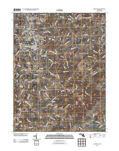
~ Hampstead MD topo map, 1:24000 scale, 7.5 X 7.5 Minute, Historical, 2011
Hampstead, Maryland, USGS topographic map dated 2011.
Includes geographic coordinates (latitude and longitude). This topographic map is suitable for hiking, camping, and exploring, or framing it as a wall map.
Printed on-demand using high resolution imagery, on heavy weight and acid free paper, or alternatively on a variety of synthetic materials.
Topos available on paper, Waterproof, Poly, or Tyvek. Usually shipping rolled, unless combined with other folded maps in one order.
- Product Number: USGS-5271798
- Free digital map download (high-resolution, GeoPDF): Hampstead, Maryland (file size: 19 MB)
- Map Size: please refer to the dimensions of the GeoPDF map above
- Weight (paper map): ca. 55 grams
- Map Type: POD USGS Topographic Map
- Map Series: US Topo
- Map Verison: Historical
- Cell ID: 19138
- Datum: North American Datum of 1983
- Map Projection: Transverse Mercator
- Map Cell Name: Hampstead
- Grid size: 7.5 X 7.5 Minute
- Date on map: 2011
- Map Scale: 1:24000
- Geographical region: Maryland, United States
Neighboring Maps:
All neighboring USGS topo maps are available for sale online at a variety of scales.
Spatial coverage:
Topo map Hampstead, Maryland, covers the geographical area associated the following places:
- Whitehouse - Trenton Mill - Scotts Ridge - Steeplechase - Trenton - Buena Vista Estates - Brilhart Terrace - Berrywood Village - Kempfield - Pleasant Grove - Hampstead Heights - Haletown - Castle Oaks - England Estates - Fowblesburg - Lees Mill - Highfield Estates - Southglenn Farms - Melanie Acres - Alma Meadows - Hampstead - Dover - Arched Bow Valley - Wolf Hill - Blue Grass Manor - Clydesdale Acres - Woodensburg - Cedarbrook - Southwood - Foreston - Clear View - Pleasant Run - Oakdale Manor - Boring - Fenwood Heights - Hampstead Valley - Crestview Meadows - Upperco - Armacost - Singer Heights - Carrs Store (historical) - Hunter Green - Roberts Field - Small Crossings - Kingston Riding
- Map Area ID: AREA39.62539.5-76.875-76.75
- Northwest corner Lat/Long code: USGSNW39.625-76.875
- Northeast corner Lat/Long code: USGSNE39.625-76.75
- Southwest corner Lat/Long code: USGSSW39.5-76.875
- Southeast corner Lat/Long code: USGSSE39.5-76.75
- Northern map edge Latitude: 39.625
- Southern map edge Latitude: 39.5
- Western map edge Longitude: -76.875
- Eastern map edge Longitude: -76.75


