
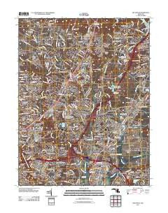
~ Beltsville MD topo map, 1:24000 scale, 7.5 X 7.5 Minute, Historical, 2011
Beltsville, Maryland, USGS topographic map dated 2011.
Includes geographic coordinates (latitude and longitude). This topographic map is suitable for hiking, camping, and exploring, or framing it as a wall map.
Printed on-demand using high resolution imagery, on heavy weight and acid free paper, or alternatively on a variety of synthetic materials.
Topos available on paper, Waterproof, Poly, or Tyvek. Usually shipping rolled, unless combined with other folded maps in one order.
- Product Number: USGS-5271786
- Free digital map download (high-resolution, GeoPDF): Beltsville, Maryland (file size: 22 MB)
- Map Size: please refer to the dimensions of the GeoPDF map above
- Weight (paper map): ca. 55 grams
- Map Type: POD USGS Topographic Map
- Map Series: US Topo
- Map Verison: Historical
- Cell ID: 3264
- Datum: North American Datum of 1983
- Map Projection: Transverse Mercator
- Map Cell Name: Beltsville
- Grid size: 7.5 X 7.5 Minute
- Date on map: 2011
- Map Scale: 1:24000
- Geographical region: Maryland, United States
Neighboring Maps:
All neighboring USGS topo maps are available for sale online at a variety of scales.
Spatial coverage:
Topo map Beltsville, Maryland, covers the geographical area associated the following places:
- Greenbelt - Cresthaven - Buck Lodge - Riding Stable Estates - Calverton - Colesville Heights - Oak Springs - Springbrook - Rocky Acres - Oakview - Spencerville Knolls - Cherry Hill - Burnt Mills Knolls - Green Castle Woods - Monteith (historical) - Rusty Acres - Good Hope - Franklin Knolls - Clifton Park Village - Burtonsville - Holly Tree Estates - Wyndham Woods - Quaint Acres - Whitehouse - Fairknoll - Spencerville - Fairland - Carole Acres - Wilshire - Knightsbridge - Beltsville Heights - Eleven Cedars - East Springbrook - Gum Springs - Powder Mill Estates - Northwest Park - Browns Corner - Fairland Acres - Bond Mill Park - McCahill Estates - New Birmingham Manor - Briggs-Chaney Estates - Homestead Estates - Adelphi - Acredale - Daniels Park - Chestnut Hills - Oakhurst - Hillsborough - Blackburn Village - Sniders Estates - White Oak - Valley Stream Estates - Fairview Estates - Burnt Mills Hills - White Oak Manor - Beltsville - Hollywood Park - Deer Park - Hillandale Forest - Hillandale - Montgomery Knolls - Springbrook Manor - Windham Manor - Avenel - Cloverly - Fairland Estates - Robeys Farmlets - Rosedale Park - Saddle Creek - Maidens Fancy Manor - Paint Branch Farms - Orchard View - Hollywood - Rolling Acres - Sandy Spring Estates - Castlegate - Fairland Heights - Muirkirk - Boxwood Village - Lewiston - Smithville - Springhill Lake - Stonewood - Rocky Gorge Estates - College Park Woods - Greencastle Manor - Ammendale - Home Acres - Good Hope Estates - Carriage Hill - Sellman Estates - Pine Hill - Cherrywood - Sequoia - Sunnyside - Vansville - Edgewood - Paint Branch Estates - Laurel Oaks
- Map Area ID: AREA39.12539-77-76.875
- Northwest corner Lat/Long code: USGSNW39.125-77
- Northeast corner Lat/Long code: USGSNE39.125-76.875
- Southwest corner Lat/Long code: USGSSW39-77
- Southeast corner Lat/Long code: USGSSE39-76.875
- Northern map edge Latitude: 39.125
- Southern map edge Latitude: 39
- Western map edge Longitude: -77
- Eastern map edge Longitude: -76.875


