
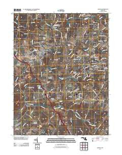
~ Urbana MD topo map, 1:24000 scale, 7.5 X 7.5 Minute, Historical, 2011
Urbana, Maryland, USGS topographic map dated 2011.
Includes geographic coordinates (latitude and longitude). This topographic map is suitable for hiking, camping, and exploring, or framing it as a wall map.
Printed on-demand using high resolution imagery, on heavy weight and acid free paper, or alternatively on a variety of synthetic materials.
Topos available on paper, Waterproof, Poly, or Tyvek. Usually shipping rolled, unless combined with other folded maps in one order.
- Product Number: USGS-5270982
- Free digital map download (high-resolution, GeoPDF): Urbana, Maryland (file size: 20 MB)
- Map Size: please refer to the dimensions of the GeoPDF map above
- Weight (paper map): ca. 55 grams
- Map Type: POD USGS Topographic Map
- Map Series: US Topo
- Map Verison: Historical
- Cell ID: 46451
- Datum: North American Datum of 1983
- Map Projection: Transverse Mercator
- Map Cell Name: Urbana
- Grid size: 7.5 X 7.5 Minute
- Date on map: 2011
- Map Scale: 1:24000
- Geographical region: Maryland, United States
Neighboring Maps:
All neighboring USGS topo maps are available for sale online at a variety of scales.
Spatial coverage:
Topo map Urbana, Maryland, covers the geographical area associated the following places:
- Shel-Mar Heights - Carolina Hills - Hyattstown - Bush Creek Estates - Urbana Overlook - Glen Cameron Estates - Ijamsville - Stone Barn Station - Sugarloaf Meadows - Fremont Hills - Hickory Hill - Fountain Mills - Pleasant Grove - Highview - Thurston - Sunnybrook Farms - Heritage Hills - Green Valley - Kinna - Hillview Acres - Turners Chance - Meadowbrook - Gently Savage - Green Hills - Water View - Friendship - Comus Sugarloaf - Sweadner - Riverwood - Quail Run - Butterfield - Smith - Monrovia - Gibralter Acres - Rolling Green - Tranquility - Permenter - Watkins Wilderness - Rangers Woods - Reels Mill - Kingsley - Weller Estates - Loch Haven - Burnt Hickory - Englandtowne - Big Woods Estates - Sleepy Hollow Estates - New Market View - Sugarloaf Vista - Chadwick - Old Orchard Estates - Lewisdale - Dennis (historical) - The Ponderosa - Oakridge - Fairfield Heights - Ijamsville Heights - Land of Promise - Urbana - Centerville
- Map Area ID: AREA39.37539.25-77.375-77.25
- Northwest corner Lat/Long code: USGSNW39.375-77.375
- Northeast corner Lat/Long code: USGSNE39.375-77.25
- Southwest corner Lat/Long code: USGSSW39.25-77.375
- Southeast corner Lat/Long code: USGSSE39.25-77.25
- Northern map edge Latitude: 39.375
- Southern map edge Latitude: 39.25
- Western map edge Longitude: -77.375
- Eastern map edge Longitude: -77.25


