
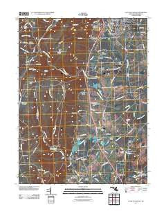
~ Catoctin Furnace MD topo map, 1:24000 scale, 7.5 X 7.5 Minute, Historical, 2011
Catoctin Furnace, Maryland, USGS topographic map dated 2011.
Includes geographic coordinates (latitude and longitude). This topographic map is suitable for hiking, camping, and exploring, or framing it as a wall map.
Printed on-demand using high resolution imagery, on heavy weight and acid free paper, or alternatively on a variety of synthetic materials.
Topos available on paper, Waterproof, Poly, or Tyvek. Usually shipping rolled, unless combined with other folded maps in one order.
- Product Number: USGS-5270934
- Free digital map download (high-resolution, GeoPDF): Catoctin Furnace, Maryland (file size: 23 MB)
- Map Size: please refer to the dimensions of the GeoPDF map above
- Weight (paper map): ca. 55 grams
- Map Type: POD USGS Topographic Map
- Map Series: US Topo
- Map Verison: Historical
- Cell ID: 7682
- Datum: North American Datum of 1983
- Map Projection: Transverse Mercator
- Map Cell Name: Catoctin Furnace
- Grid size: 7.5 X 7.5 Minute
- Date on map: 2011
- Map Scale: 1:24000
- Geographical region: Maryland, United States
Neighboring Maps:
All neighboring USGS topo maps are available for sale online at a variety of scales.
Spatial coverage:
Topo map Catoctin Furnace, Maryland, covers the geographical area associated the following places:
- Free Farms - Cliffton Estates - Harmony Hill - White Rocks - Graceham - Hunting Creek Acres - Willis Acres - Gateway - Covered Bridge Estates - Catoctin Furnace - Lewisdale Estates - Larvadale Estates - Leisure Mountain - Mount Prospect Estates - Lewistown - Tuscarora Springs - Altogether - Sunday - Mills Manor - Blue Mountain - Kesselring - Fraley Acres - Jimtown - Poplar Knob - Utica Mills Estates - Heatherview - Devilbiss Estates - Locust Grove - Lost Eden - Mountaindale - Laurelcrest - Williar - Bethel - Thurmont Overlook - Knowles - Thurmont - Utica - Sandy Run Estates - Ziegler Estates - Baugher Woods
- Map Area ID: AREA39.62539.5-77.5-77.375
- Northwest corner Lat/Long code: USGSNW39.625-77.5
- Northeast corner Lat/Long code: USGSNE39.625-77.375
- Southwest corner Lat/Long code: USGSSW39.5-77.5
- Southeast corner Lat/Long code: USGSSE39.5-77.375
- Northern map edge Latitude: 39.625
- Southern map edge Latitude: 39.5
- Western map edge Longitude: -77.5
- Eastern map edge Longitude: -77.375


