
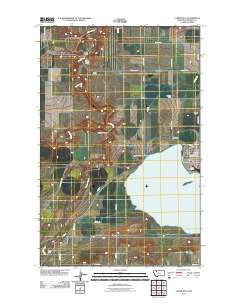
~ Valier West MT topo map, 1:24000 scale, 7.5 X 7.5 Minute, Historical, 2011
Valier West, Montana, USGS topographic map dated 2011.
Includes geographic coordinates (latitude and longitude). This topographic map is suitable for hiking, camping, and exploring, or framing it as a wall map.
Printed on-demand using high resolution imagery, on heavy weight and acid free paper, or alternatively on a variety of synthetic materials.
Topos available on paper, Waterproof, Poly, or Tyvek. Usually shipping rolled, unless combined with other folded maps in one order.
- Product Number: USGS-5270856
- Free digital map download (high-resolution, GeoPDF): Valier West, Montana (file size: 11 MB)
- Map Size: please refer to the dimensions of the GeoPDF map above
- Weight (paper map): ca. 55 grams
- Map Type: POD USGS Topographic Map
- Map Series: US Topo
- Map Verison: Historical
- Cell ID: 46542
- Datum: North American Datum of 1983
- Map Projection: Transverse Mercator
- Map Cell Name: Valier West
- Grid size: 7.5 X 7.5 Minute
- Date on map: 2011
- Map Scale: 1:24000
- Geographical region: Montana, United States
Neighboring Maps:
All neighboring USGS topo maps are available for sale online at a variety of scales.
Spatial coverage:
Topo map Valier West, Montana, covers the geographical area associated the following places:
- 29N06W24DABA01 Well - Lake Frances - Dupuyer Creek - A 4 Canal - A Canal - Valier Volunteer Fire Department - C Canal - First Baptist Church - Valier High School - Valier Lutheran Church - Valier United Methodist Church - Birch Creek Bridge - Valier Elementary School - Laughlin Coulee - Lake Frances North Dam - AN Two Canal - Wayman Ranch - Miller Park - Frances Heights School (historical) - 30N05W33DDB_01 Well - Birchfield School (historical) - Valier Public Library - Parker Ranch - C 3 Canal - Goolin Ranch - Kilian Ranch - Saint Francis Catholic Church - Mountain View School (historical) - Valier - Highland School (historical) - Home Ranch - Valier Clinic - Lakeview Cemetery - Town of Valier
- Map Area ID: AREA48.37548.25-112.375-112.25
- Northwest corner Lat/Long code: USGSNW48.375-112.375
- Northeast corner Lat/Long code: USGSNE48.375-112.25
- Southwest corner Lat/Long code: USGSSW48.25-112.375
- Southeast corner Lat/Long code: USGSSE48.25-112.25
- Northern map edge Latitude: 48.375
- Southern map edge Latitude: 48.25
- Western map edge Longitude: -112.375
- Eastern map edge Longitude: -112.25


