
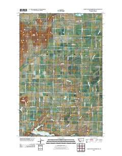
~ Lower Crow Reservoir MT topo map, 1:24000 scale, 7.5 X 7.5 Minute, Historical, 2011
Lower Crow Reservoir, Montana, USGS topographic map dated 2011.
Includes geographic coordinates (latitude and longitude). This topographic map is suitable for hiking, camping, and exploring, or framing it as a wall map.
Printed on-demand using high resolution imagery, on heavy weight and acid free paper, or alternatively on a variety of synthetic materials.
Topos available on paper, Waterproof, Poly, or Tyvek. Usually shipping rolled, unless combined with other folded maps in one order.
- Product Number: USGS-5270309
- Free digital map download (high-resolution, GeoPDF): Lower Crow Reservoir, Montana (file size: 12 MB)
- Map Size: please refer to the dimensions of the GeoPDF map above
- Weight (paper map): ca. 55 grams
- Map Type: POD USGS Topographic Map
- Map Series: US Topo
- Map Verison: Historical
- Cell ID: 26795
- Datum: North American Datum of 1983
- Map Projection: Transverse Mercator
- Map Cell Name: Lower Crow Reservoir
- Grid size: 7.5 X 7.5 Minute
- Date on map: 2011
- Map Scale: 1:24000
- Geographical region: Montana, United States
Neighboring Maps:
All neighboring USGS topo maps are available for sale online at a variety of scales.
Spatial coverage:
Topo map Lower Crow Reservoir, Montana, covers the geographical area associated the following places:
- 21N20W33AAA_01 Well - 21N20W17BCC_01 Well - Pablo 10A Canal - West Miller Coulee - 20N20W05BBA_01 Well - Pablo 71A Canal - Lower Crow Reservoir - 21N20W35CDC_01 Well - Pablo 37A Canal - Pablo District - 20N20W07ABDC01 Well - 20N20W04BAA_01 Well - Sloan Buttes - Sloan Lake - Pablo 37A4 Canal - Pablo 50A Canal - Crow Dam - Pablo A Canal - 20N20W03CCA_01 Well - 20N20W05DDD_01 Well - Pablo 37Aa Canal - Round Butte - 21N21W26DAD_01 Well - Pablo 7oA Canal - 21N20W21ADD_01 Well - 21N20W28BBA_01 Well - Mud Creek - Pablo 31 A 07 Canal - Stinger Creek - 21N21W25BBB_01 Well - Mission Mountain Country Club - 21N20W15BAA_01 Well - 21N20W31AABB01 Well - 21N20W05CBBB01 Well - 20N21W02BCD_01 Well - 22N20W31CDD_01 Well - Pablo 53A Canal - 21N20W22BABA01 Well - Valley View Hills - 20N20W07ABDD01 Well - 21N20W27BBCC01 Well - Pablo 13A Canal - 21N20W09AAAB01 Well - Flathead Division - 21N20W23BDD_01 Well - 20N20W07AAAD01 Well - 21N20W19BCB_01 Well - 20N21W01AAA_01 Well - 21N21W02AAD_01 Well - 21N20W20AADA01 Well - 21N21W36CBA_01 Well
- Map Area ID: AREA47.62547.5-114.25-114.125
- Northwest corner Lat/Long code: USGSNW47.625-114.25
- Northeast corner Lat/Long code: USGSNE47.625-114.125
- Southwest corner Lat/Long code: USGSSW47.5-114.25
- Southeast corner Lat/Long code: USGSSE47.5-114.125
- Northern map edge Latitude: 47.625
- Southern map edge Latitude: 47.5
- Western map edge Longitude: -114.25
- Eastern map edge Longitude: -114.125


