
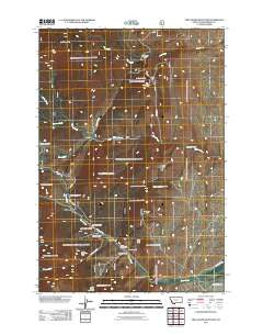
~ Twin Adams Mountain MT topo map, 1:24000 scale, 7.5 X 7.5 Minute, Historical, 2011
Twin Adams Mountain, Montana, USGS topographic map dated 2011.
Includes geographic coordinates (latitude and longitude). This topographic map is suitable for hiking, camping, and exploring, or framing it as a wall map.
Printed on-demand using high resolution imagery, on heavy weight and acid free paper, or alternatively on a variety of synthetic materials.
Topos available on paper, Waterproof, Poly, or Tyvek. Usually shipping rolled, unless combined with other folded maps in one order.
- Product Number: USGS-5270089
- Free digital map download (high-resolution, GeoPDF): Twin Adams Mountain, Montana (file size: 17 MB)
- Map Size: please refer to the dimensions of the GeoPDF map above
- Weight (paper map): ca. 55 grams
- Map Type: POD USGS Topographic Map
- Map Series: US Topo
- Map Verison: Historical
- Cell ID: 46082
- Datum: North American Datum of 1983
- Map Projection: Transverse Mercator
- Map Cell Name: Twin Adams Mountain
- Grid size: 7.5 X 7.5 Minute
- Date on map: 2011
- Map Scale: 1:24000
- Geographical region: Montana, United States
Neighboring Maps:
All neighboring USGS topo maps are available for sale online at a variety of scales.
Spatial coverage:
Topo map Twin Adams Mountain, Montana, covers the geographical area associated the following places:
- Sheep Creek - Indian Queen Mine - DuBois Creek - Canyon Gulch - Middle Mountain - Thunderhead Mountain - Aspen Campground - Greenstone Mine - Cow Camp - Meyers Gulch - Farlin School (historical) - Spring Gulch - Farlin (historical) - Barbour Gulch - Lost Fraction Mine - Lime Gulch Mine - Limestone Mountain - Barbour Gulch Mine - Sugar Loaf Mine - Glowworm/Greenhorn Mine - Thief Creek - Armstrong Gulch - SE SW Section 16 Mine - Bond Creek - North Creek - Upper Bridge Gulch Mine - Farlin Gulch - Lime Gulch - Farlin Post Office (historical) - Call Mountain - Birch Creek Ranger Station - Armstrong Mountain - Twin Adams Mine - 05S10W02DABB01 Spring - Twin Adams Mountain - Bond Lake Dam - Lower Bridge Gulch Mine - Greenstone Mountain - Bridge Gulch
- Map Area ID: AREA45.545.375-112.875-112.75
- Northwest corner Lat/Long code: USGSNW45.5-112.875
- Northeast corner Lat/Long code: USGSNE45.5-112.75
- Southwest corner Lat/Long code: USGSSW45.375-112.875
- Southeast corner Lat/Long code: USGSSE45.375-112.75
- Northern map edge Latitude: 45.5
- Southern map edge Latitude: 45.375
- Western map edge Longitude: -112.875
- Eastern map edge Longitude: -112.75


