
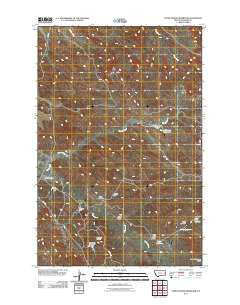
~ Upper Magpie Reservoir MT topo map, 1:24000 scale, 7.5 X 7.5 Minute, Historical, 2011
Upper Magpie Reservoir, Montana, USGS topographic map dated 2011.
Includes geographic coordinates (latitude and longitude). This topographic map is suitable for hiking, camping, and exploring, or framing it as a wall map.
Printed on-demand using high resolution imagery, on heavy weight and acid free paper, or alternatively on a variety of synthetic materials.
Topos available on paper, Waterproof, Poly, or Tyvek. Usually shipping rolled, unless combined with other folded maps in one order.
- Product Number: USGS-5269215
- Free digital map download (high-resolution, GeoPDF): Upper Magpie Reservoir, Montana (file size: 16 MB)
- Map Size: please refer to the dimensions of the GeoPDF map above
- Weight (paper map): ca. 55 grams
- Map Type: POD USGS Topographic Map
- Map Series: US Topo
- Map Verison: Historical
- Cell ID: 46414
- Datum: North American Datum of 1983
- Map Projection: Transverse Mercator
- Map Cell Name: Upper Magpie Reservoir
- Grid size: 7.5 X 7.5 Minute
- Date on map: 2011
- Map Scale: 1:24000
- Geographical region: Montana, United States
Neighboring Maps:
All neighboring USGS topo maps are available for sale online at a variety of scales.
Spatial coverage:
Topo map Upper Magpie Reservoir, Montana, covers the geographical area associated the following places:
- Upper Prairie Goat Dam - Camp Reservoir - Forks Reservoir - Upper Magpie Reservoir - Prairie Goat Dam - Juniper Dam - 13N56E30CCBC01 Well - Abbot Draw - Upper Magpie Reservoir Dam - 14N55E27CD__01 Well - North Pine Oil Field - Ceder Bell Number 2 Dam - Gas City Oil Field - Bailer Reservoir Dam - Basin View Dam - Gertison Dam - Magpie Creek - Prairie Goat Reservoir - Dead Horse Dam - Twin Buttes Retention Dam - Bailer Reservoir - 14N55E27CDDB01 Well - 14N56E09ADDB01 Well - Big Drop Reservoir - 14N56E21ABAD01 Well - Gertison Dam
- Map Area ID: AREA4746.875-104.75-104.625
- Northwest corner Lat/Long code: USGSNW47-104.75
- Northeast corner Lat/Long code: USGSNE47-104.625
- Southwest corner Lat/Long code: USGSSW46.875-104.75
- Southeast corner Lat/Long code: USGSSE46.875-104.625
- Northern map edge Latitude: 47
- Southern map edge Latitude: 46.875
- Western map edge Longitude: -104.75
- Eastern map edge Longitude: -104.625


