
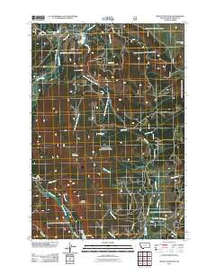
~ Selway Mountain MT topo map, 1:24000 scale, 7.5 X 7.5 Minute, Historical, 2011
Selway Mountain, Montana, USGS topographic map dated 2011.
Includes geographic coordinates (latitude and longitude). This topographic map is suitable for hiking, camping, and exploring, or framing it as a wall map.
Printed on-demand using high resolution imagery, on heavy weight and acid free paper, or alternatively on a variety of synthetic materials.
Topos available on paper, Waterproof, Poly, or Tyvek. Usually shipping rolled, unless combined with other folded maps in one order.
- Product Number: USGS-5266974
- Free digital map download (high-resolution, GeoPDF): Selway Mountain, Montana (file size: 18 MB)
- Map Size: please refer to the dimensions of the GeoPDF map above
- Weight (paper map): ca. 55 grams
- Map Type: POD USGS Topographic Map
- Map Series: US Topo
- Map Verison: Historical
- Cell ID: 40536
- Datum: North American Datum of 1983
- Map Projection: Transverse Mercator
- Map Cell Name: Selway Mountain
- Grid size: 7.5 X 7.5 Minute
- Date on map: 2011
- Map Scale: 1:24000
- Geographical region: Montana, United States
Neighboring Maps:
All neighboring USGS topo maps are available for sale online at a variety of scales.
Spatial coverage:
Topo map Selway Mountain, Montana, covers the geographical area associated the following places:
- C L Creek - U-Turn Creek - Englebaugh Creek - Ore Creek - Dunkwaden Flats - Short Creek - Mud Lake - Jackson Cow Camp - Selway Mountain - Saginaw Mine - Jahnke Creek - LC Cow Camp - Black Mountain - Saginaw Mine - East Fork Englebaugh Creek - Dunkwaden Flats - Surveyor Creek - Stover Creek - Lazy Jackson Dam - Park Creek - Reservoir Lake Dam - Van Houten Lake - 07S15W08BBBC01 Well - Pioneer Creek - Hidden Creek - Reservoir Lake - Dean Creek - South Van Houten Recreation Site - 07S15W07AADD01 Spring - North Van Houten Recreation Site - West Fork Englebaugh Creek - Fish Ranch Airport
- Map Area ID: AREA45.2545.125-113.5-113.375
- Northwest corner Lat/Long code: USGSNW45.25-113.5
- Northeast corner Lat/Long code: USGSNE45.25-113.375
- Southwest corner Lat/Long code: USGSSW45.125-113.5
- Southeast corner Lat/Long code: USGSSE45.125-113.375
- Northern map edge Latitude: 45.25
- Southern map edge Latitude: 45.125
- Western map edge Longitude: -113.5
- Eastern map edge Longitude: -113.375


