
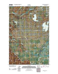
~ Browns Lake MT topo map, 1:24000 scale, 7.5 X 7.5 Minute, Historical, 2011
Browns Lake, Montana, USGS topographic map dated 2011.
Includes geographic coordinates (latitude and longitude). This topographic map is suitable for hiking, camping, and exploring, or framing it as a wall map.
Printed on-demand using high resolution imagery, on heavy weight and acid free paper, or alternatively on a variety of synthetic materials.
Topos available on paper, Waterproof, Poly, or Tyvek. Usually shipping rolled, unless combined with other folded maps in one order.
- Product Number: USGS-5266810
- Free digital map download (high-resolution, GeoPDF): Browns Lake, Montana (file size: 13 MB)
- Map Size: please refer to the dimensions of the GeoPDF map above
- Weight (paper map): ca. 55 grams
- Map Type: POD USGS Topographic Map
- Map Series: US Topo
- Map Verison: Historical
- Cell ID: 5727
- Datum: North American Datum of 1983
- Map Projection: Transverse Mercator
- Map Cell Name: Browns Lake
- Grid size: 7.5 X 7.5 Minute
- Date on map: 2011
- Map Scale: 1:24000
- Geographical region: Montana, United States
Neighboring Maps:
All neighboring USGS topo maps are available for sale online at a variety of scales.
Spatial coverage:
Topo map Browns Lake, Montana, covers the geographical area associated the following places:
- 14N12W36DCCC01 Well - Kleinschmidt Creek - Douglas Creek - Harry Morgan Fishing Access Site - Wales Creek - 14N11W08ADAC01 Well - First Chance Creek Placer Mine - Browns Lake - Cedar Meadow Fishing Access Site - Nevada Creek - 13N12W12DCDD01 Well - Kleinschmidt Lake - Rock Creek - Company Ditch - 13N12W12CAAB01 Well - Ward Creek - Nevada Valley - Yourname Creek - Long Lake - Aunt Molly Fishing Access Site - Lake City Post Office (historical) - 13N12W12CAAA02 Well - Browns Lake Fishing Access Site - Dry Gulch - 14N12W22DBAD01 Well - McElwain Creek - Frazier Creek - Raymond Bridge
- Map Area ID: AREA4746.875-113.125-113
- Northwest corner Lat/Long code: USGSNW47-113.125
- Northeast corner Lat/Long code: USGSNE47-113
- Southwest corner Lat/Long code: USGSSW46.875-113.125
- Southeast corner Lat/Long code: USGSSE46.875-113
- Northern map edge Latitude: 47
- Southern map edge Latitude: 46.875
- Western map edge Longitude: -113.125
- Eastern map edge Longitude: -113


