
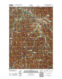
~ Beaver Creek School MT topo map, 1:24000 scale, 7.5 X 7.5 Minute, Historical, 2011
Beaver Creek School, Montana, USGS topographic map dated 2011.
Includes geographic coordinates (latitude and longitude). This topographic map is suitable for hiking, camping, and exploring, or framing it as a wall map.
Printed on-demand using high resolution imagery, on heavy weight and acid free paper, or alternatively on a variety of synthetic materials.
Topos available on paper, Waterproof, Poly, or Tyvek. Usually shipping rolled, unless combined with other folded maps in one order.
- Product Number: USGS-5266632
- Free digital map download (high-resolution, GeoPDF): Beaver Creek School, Montana (file size: 18 MB)
- Map Size: please refer to the dimensions of the GeoPDF map above
- Weight (paper map): ca. 55 grams
- Map Type: POD USGS Topographic Map
- Map Series: US Topo
- Map Verison: Historical
- Cell ID: 2935
- Datum: North American Datum of 1983
- Map Projection: Transverse Mercator
- Map Cell Name: Beaver Creek School
- Grid size: 7.5 X 7.5 Minute
- Date on map: 2011
- Map Scale: 1:24000
- Geographical region: Montana, United States
Neighboring Maps:
All neighboring USGS topo maps are available for sale online at a variety of scales.
Spatial coverage:
Topo map Beaver Creek School, Montana, covers the geographical area associated the following places:
- 02S46E10DBDA01 Spring - Funnel Draw - Deer Creek Reservoir Number Two - 01S45E36DABC01 Well - Sartin Draw Reservoir - Cabin Creek Well - 02S46E02DBBB01 Well - West Fork Ash Creek - North Sartin Draw - Maxwell Creek - Schiller Reservoir - Upper Deer Creek Well - 02S46E22DBCA01 Spring - North Fork Beaver Creek - Main Ash Reservoir - Ash Creek - 01S46E33DADB01 Well - 02S46E08CCCD01 Spring - Darling Draw Spring - Deer Creek Reservoir Number Three - Deer Creek Spring - 02S46E09ACBD01 Well - Sawmill Reservoir - Cabin Creek - 01S46E30ADCA01 Well - Maxwell Well - 01S46E34CBDA01 Well - 02S46E03CA__01 Well - 02S46E17BACA01 Spring - Cabin Creek Spring - Schiller Creek - Beaver Creek Spring - 01S46E21DCBC01 Well - Lower Deer Creek Well - 01S46E30DBDC01 Well - 01S45E25DDCA01 Well - 01S46E30ADCA02 Well - 02S46E05AACB01 Well - East Fork Beaver Creek - Maxwell Spring - 02S46E15BDBC01 Well - Straight Creek - Beaver Creek School (historical) - Sheep Creek - 01S46E29BBDA01 Well - 01S46E28BAAB01 Well - Sartin Draw - Main Ash Spring - 01S46E27BCBC01 Well - 01S46E28ADDD01 Well - Deer Creek - Deer Creek Reservoir Number One
- Map Area ID: AREA45.7545.625-106.125-106
- Northwest corner Lat/Long code: USGSNW45.75-106.125
- Northeast corner Lat/Long code: USGSNE45.75-106
- Southwest corner Lat/Long code: USGSSW45.625-106.125
- Southeast corner Lat/Long code: USGSSE45.625-106
- Northern map edge Latitude: 45.75
- Southern map edge Latitude: 45.625
- Western map edge Longitude: -106.125
- Eastern map edge Longitude: -106


