
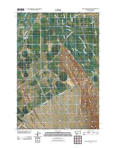
~ Beaverhead Rock NE MT topo map, 1:24000 scale, 7.5 X 7.5 Minute, Historical, 2011
Beaverhead Rock NE, Montana, USGS topographic map dated 2011.
Includes geographic coordinates (latitude and longitude). This topographic map is suitable for hiking, camping, and exploring, or framing it as a wall map.
Printed on-demand using high resolution imagery, on heavy weight and acid free paper, or alternatively on a variety of synthetic materials.
Topos available on paper, Waterproof, Poly, or Tyvek. Usually shipping rolled, unless combined with other folded maps in one order.
- Product Number: USGS-5266620
- Free digital map download (high-resolution, GeoPDF): Beaverhead Rock NE, Montana (file size: 12 MB)
- Map Size: please refer to the dimensions of the GeoPDF map above
- Weight (paper map): ca. 55 grams
- Map Type: POD USGS Topographic Map
- Map Series: US Topo
- Map Verison: Historical
- Cell ID: 2962
- Datum: North American Datum of 1983
- Map Projection: Transverse Mercator
- Map Cell Name: Beaverhead Rock NE
- Grid size: 7.5 X 7.5 Minute
- Date on map: 2011
- Map Scale: 1:24000
- Geographical region: Montana, United States
Neighboring Maps:
All neighboring USGS topo maps are available for sale online at a variety of scales.
Spatial coverage:
Topo map Beaverhead Rock NE, Montana, covers the geographical area associated the following places:
- 05S06W10BCCA01 Well - Castle Rock - 05S06W12BBB01_ Well - Mill Creek - 05S06W17CAB_01 Well - 04S06W32ABBA02 Well - 05S06W03BBB_01 Well - 04S05W18CAAC01 Well - Leonard Slough - Silver Springs (historical) - 04S06W26ABA_02 Well - 04S06W32ABB_02 Well - Wet Georgia Gulch - Wisconsin Creek - 04S06W27BAAA01 Well - Left Fork Leonard Slough - Cottonwood Ranch (historical) - 04S06W29AABA01 Well - 05S05W05CCCA01 Well - Indian Creek - 04S06W35BBBB01 Well - 05S06W04BDA_01 Well - 04S06W16DDDD02 Well - Beaverhead River Bridge - Duncan School (historical) - 04S06W26ABB_02 Well - Sarge Hall Ditch - 05S06W03AAB_01 Well - 05S06W15ACB_01 Well - 04S06W16AAAA02 Well - 05S05W05CCAA01 Well
- Map Area ID: AREA45.545.375-112.375-112.25
- Northwest corner Lat/Long code: USGSNW45.5-112.375
- Northeast corner Lat/Long code: USGSNE45.5-112.25
- Southwest corner Lat/Long code: USGSSW45.375-112.375
- Southeast corner Lat/Long code: USGSSE45.375-112.25
- Northern map edge Latitude: 45.5
- Southern map edge Latitude: 45.375
- Western map edge Longitude: -112.375
- Eastern map edge Longitude: -112.25


