
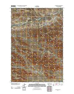
~ Colstrip SW MT topo map, 1:24000 scale, 7.5 X 7.5 Minute, Historical, 2011
Colstrip SW, Montana, USGS topographic map dated 2011.
Includes geographic coordinates (latitude and longitude). This topographic map is suitable for hiking, camping, and exploring, or framing it as a wall map.
Printed on-demand using high resolution imagery, on heavy weight and acid free paper, or alternatively on a variety of synthetic materials.
Topos available on paper, Waterproof, Poly, or Tyvek. Usually shipping rolled, unless combined with other folded maps in one order.
- Product Number: USGS-5266528
- Free digital map download (high-resolution, GeoPDF): Colstrip SW, Montana (file size: 16 MB)
- Map Size: please refer to the dimensions of the GeoPDF map above
- Weight (paper map): ca. 55 grams
- Map Type: POD USGS Topographic Map
- Map Series: US Topo
- Map Verison: Historical
- Cell ID: 9661
- Datum: North American Datum of 1983
- Map Projection: Transverse Mercator
- Map Cell Name: Colstrip SW
- Grid size: 7.5 X 7.5 Minute
- Date on map: 2011
- Map Scale: 1:24000
- Geographical region: Montana, United States
Neighboring Maps:
All neighboring USGS topo maps are available for sale online at a variety of scales.
Spatial coverage:
Topo map Colstrip SW, Montana, covers the geographical area associated the following places:
- 01N41E06DDDB01 Well - 01N41E21DADA02 Well - 01N40E36BDBC01 Well - 01N41E03CCDC03 Well - 01N41E03CCDC02 Well - 01N41E29BBAA01 Well - 01N41E30BBCD01 Well - 01N41E03CCDC01 Well - 01N41E21DADA01 Well - 01N40E02BCAB01 Well - 01N41E29BBAA02 Well - 01N41E08CBAB01 Well - 01N41E33BCCB01 Well - 01N41E17BBBB01 Well - 01N40E12CBAA01 Well - 01N40E02BDAB01 Spring - 01N40E15BBAB01 Well - 01N41E21DBDB01 Well - 01S41E06AADB01 Well - 01N41E22CC__01 Well - 01N41E21DADC01 Well - 01N40E36BDBC02 Well - 01N40E15BBDA01 Well - 01N40E02CDCC01 Well - Rape Coulee - 01N41E22CCDC01 Well - 01N40E36BACD01 Well - McKay School (historical) - 01N41E04AADB01 Well - 01N41E16BABA02 Well - Wayne Post Office (historical) - 01S41E17DAAA01 Well - 01N41E21DBDB02 Well - 01N41E16BABA01 Well - 01N40E24CACB01 Well - 01N41E04ADAA01 Well - 01N41E07DBBA01 Well - 01N41E18ADCC01 Well - Colstrip Airport - Kimball School (historical) - 01N41E31AADA01 Well - 01S40E12DDD_01 Spring - 01N40E13CCDC02 Well - 01N40E02BBDD01 Spring - 01N40E11ABBB01 Well - 01N40E02BACD01 Well - 01N40E12DCCD01 Well - 01N41E21DADC02 Well - 01N41E28BDCB01 Well - 01N40E15BDBD01 Well - 01N41E04DDBA01 Well - 01N40E02BACA01 Well - 01N40E02BABD01 Spring - 01N41E08CBAB02 Well - 01N41E21DADB01 Well - 01N41E04AABB01 Well - 01N40E14BBBB01 Well - 01N40E13CCDC03 Well - 01N41E04AABD01 Well - 01N40E35DBBC01 Well - 01N40E10DADB01 Well - 01N41E28BDCB02 Well - 01N40E01CCCD01 Well - 01N41E18ADCC02 Well - 01N40E15BDBB01 Well - 01N40E14BBBB02 Well - 01N40E13ABAA01 Well - 01N41E04AADD01 Well - 01N41E06C___01 Well - 01N40E13CCDC01 Well - 01N40E02CDCC01 Well - 01N41E04AADB02 Well
- Map Area ID: AREA45.87545.75-106.75-106.625
- Northwest corner Lat/Long code: USGSNW45.875-106.75
- Northeast corner Lat/Long code: USGSNE45.875-106.625
- Southwest corner Lat/Long code: USGSSW45.75-106.75
- Southeast corner Lat/Long code: USGSSE45.75-106.625
- Northern map edge Latitude: 45.875
- Southern map edge Latitude: 45.75
- Western map edge Longitude: -106.75
- Eastern map edge Longitude: -106.625


