
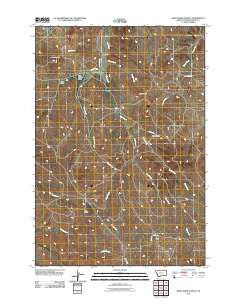
~ Bear Creek School MT topo map, 1:24000 scale, 7.5 X 7.5 Minute, Historical, 2011
Bear Creek School, Montana, USGS topographic map dated 2011.
Includes geographic coordinates (latitude and longitude). This topographic map is suitable for hiking, camping, and exploring, or framing it as a wall map.
Printed on-demand using high resolution imagery, on heavy weight and acid free paper, or alternatively on a variety of synthetic materials.
Topos available on paper, Waterproof, Poly, or Tyvek. Usually shipping rolled, unless combined with other folded maps in one order.
- Product Number: USGS-5266506
- Free digital map download (high-resolution, GeoPDF): Bear Creek School, Montana (file size: 15 MB)
- Map Size: please refer to the dimensions of the GeoPDF map above
- Weight (paper map): ca. 55 grams
- Map Type: POD USGS Topographic Map
- Map Series: US Topo
- Map Verison: Historical
- Cell ID: 2812
- Datum: North American Datum of 1983
- Map Projection: Transverse Mercator
- Map Cell Name: Bear Creek School
- Grid size: 7.5 X 7.5 Minute
- Date on map: 2011
- Map Scale: 1:24000
- Geographical region: Montana, United States
Neighboring Maps:
All neighboring USGS topo maps are available for sale online at a variety of scales.
Spatial coverage:
Topo map Bear Creek School, Montana, covers the geographical area associated the following places:
- 08S45E33BADB01 Well - 09S45E27BBBB01 Well - Boxelder Creek - 09S45E11ADDB01 Well - 09S45E15CDAA01 Well - 09S45E03DABB01 Well - 08S45E33BAAC02 Well - 09S45E03DABB03 Well - 09S45E23DDCC01 Well - 08S45E31DABB01 Spring - 08S45E34CAAC01 Well - 09S45E11BCCB01 Well - Dufford Cemetery - Vance Creek - 08S45E27CCAD01 Well - Red Butte - 09S45E05BBAA01 Well - 09S45E03BAAA01 Well - 09S46E07DCBB02 Well - 09S45E02CBAD01 Well - Finn Creek - 08S45E36ADBA01 Well - 09S45E12CBCC01 Well - 08S45E34BBBB01 Well - 09S45E14BACB01 Well - 09S45E03ADCC02 Well - 09S45E03ADCC04 Well - 08S45E27BDBD02 Well - 08S45E33BAAC01 Well - 08S45E27BDBD01 Well - 08S45E34CABC01 Well - 08S45E33BBDA01 Well - 08S45E34BBCB01 Well - 08S46E30CCCB01 Spring - 09S45E03AADD01 Well - 09S45E11BCDA01 Well - 09S45E16AAAD01 Well - 09S45E03BBBB01 Well - 09S45E03CCBC01 Well - Chico Buttes - 08S45E32BCAD01 Well - 08S45E28AACC01 Well - 08S45E34DADD01 Well - 09S45E11BCDA02 Well - 09S45E03DABB04 Well - 08S45E36BCCC01 Well - 09S45E03DABB02 Well - 09S46E07DDCD01 Well - 08S45E25DACD01 Well - 08S46E19DCBC01 Well - 09S45E09ABDA01 Well - 09S45E20ACCD01 Well - Bear Creek School (historical) - 08S45E34CAAB01 Well - 08S45E27BDBD03 Well - 09S45E04BACD01 Well - 09S45E03ADCC01 Well - 08S45E33BBDD01 Well - Nipple Butte - 09S45E04DCAB01 Well - 08S46E19DCCA01 Well - Mac Alister Draw - 09S45E11CCAA01 Well - 09S45E23DDCC02 Well - 09S45E03ADCC03 Well - 08S45E33AADA01 Well - Bales Creek - 09S46E07DCBB01 Well - 09S45E02BBCA01 Well - 08S45E27CCAA01 Well - 08S45E25DACD02 Well - 08S45E30ABAA01 Well - Cedar Creek - 08S45E34BCBC01 Well - 08S45E24CADD01 Spring - Jojo Draw - 09S45E36CAAA01 Well - 08S45E34ABDA01 Well - 09S45E03DABB05 Well
- Map Area ID: AREA45.12545-106.25-106.125
- Northwest corner Lat/Long code: USGSNW45.125-106.25
- Northeast corner Lat/Long code: USGSNE45.125-106.125
- Southwest corner Lat/Long code: USGSSW45-106.25
- Southeast corner Lat/Long code: USGSSE45-106.125
- Northern map edge Latitude: 45.125
- Southern map edge Latitude: 45
- Western map edge Longitude: -106.25
- Eastern map edge Longitude: -106.125


