
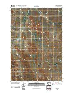
~ T Creek MT topo map, 1:24000 scale, 7.5 X 7.5 Minute, Historical, 2011
T Creek, Montana, USGS topographic map dated 2011.
Includes geographic coordinates (latitude and longitude). This topographic map is suitable for hiking, camping, and exploring, or framing it as a wall map.
Printed on-demand using high resolution imagery, on heavy weight and acid free paper, or alternatively on a variety of synthetic materials.
Topos available on paper, Waterproof, Poly, or Tyvek. Usually shipping rolled, unless combined with other folded maps in one order.
- Product Number: USGS-5266473
- Free digital map download (high-resolution, GeoPDF): T Creek, Montana (file size: 13 MB)
- Map Size: please refer to the dimensions of the GeoPDF map above
- Weight (paper map): ca. 55 grams
- Map Type: POD USGS Topographic Map
- Map Series: US Topo
- Map Verison: Historical
- Cell ID: 44118
- Datum: North American Datum of 1983
- Map Projection: Transverse Mercator
- Map Cell Name: T Creek
- Grid size: 7.5 X 7.5 Minute
- Date on map: 2011
- Map Scale: 1:24000
- Geographical region: Montana, United States
Neighboring Maps:
All neighboring USGS topo maps are available for sale online at a variety of scales.
Spatial coverage:
Topo map T Creek, Montana, covers the geographical area associated the following places:
- Charles Creek - Lake Creek - 03S51E03CADB01 Well - T Creek - Ash Creek - 03S52E31CAAC01 Well - Dry Creek - Moonlight Creek - 03S50E12AACB01 Well - Twin Buttes - Short Creek - 03S50E24DDAB01 Well - 03S51E26BDCA01 Well - Double Corral Creek - 02S51E31CAAD01 Well - 03S51E14ABAB01 Well - 03S51E17CDCB01 Well - 03S51E04BBDA01 Well - Emmons Number 1 Dam - 03S51E30DABB01 Well - 03S51E10AABB01 Well - Broadus Division - 03S51E21ADCB01 Well - 03S51E08DCAB01 Well - 03S51E34CBC_01 Well - 03S51E34BADD01 Well - Flat Creek
- Map Area ID: AREA45.62545.5-105.5-105.375
- Northwest corner Lat/Long code: USGSNW45.625-105.5
- Northeast corner Lat/Long code: USGSNE45.625-105.375
- Southwest corner Lat/Long code: USGSSW45.5-105.5
- Southeast corner Lat/Long code: USGSSE45.5-105.375
- Northern map edge Latitude: 45.625
- Southern map edge Latitude: 45.5
- Western map edge Longitude: -105.5
- Eastern map edge Longitude: -105.375


