
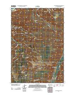
~ Soda Springs NW MT topo map, 1:24000 scale, 7.5 X 7.5 Minute, Historical, 2011
Soda Springs NW, Montana, USGS topographic map dated 2011.
Includes geographic coordinates (latitude and longitude). This topographic map is suitable for hiking, camping, and exploring, or framing it as a wall map.
Printed on-demand using high resolution imagery, on heavy weight and acid free paper, or alternatively on a variety of synthetic materials.
Topos available on paper, Waterproof, Poly, or Tyvek. Usually shipping rolled, unless combined with other folded maps in one order.
- Product Number: USGS-5266105
- Free digital map download (high-resolution, GeoPDF): Soda Springs NW, Montana (file size: 15 MB)
- Map Size: please refer to the dimensions of the GeoPDF map above
- Weight (paper map): ca. 55 grams
- Map Type: POD USGS Topographic Map
- Map Series: US Topo
- Map Verison: Historical
- Cell ID: 41986
- Datum: North American Datum of 1983
- Map Projection: Transverse Mercator
- Map Cell Name: Soda Springs NW
- Grid size: 7.5 X 7.5 Minute
- Date on map: 2011
- Map Scale: 1:24000
- Geographical region: Montana, United States
Neighboring Maps:
All neighboring USGS topo maps are available for sale online at a variety of scales.
Spatial coverage:
Topo map Soda Springs NW, Montana, covers the geographical area associated the following places:
- Big Coulee - 02S26E02BDD_01 Well - B O'Leary Number 2 Dam - South Yellowstone Division - West Buckeye Creek - West Wets Creek - 01S26E13D___01 Well - East Buckeye Creek - Little Basin Creek - Dirt Creek - Billings Racetrack - Pictograph Cave State Park - Morin School
- Map Area ID: AREA45.7545.625-108.5-108.375
- Northwest corner Lat/Long code: USGSNW45.75-108.5
- Northeast corner Lat/Long code: USGSNE45.75-108.375
- Southwest corner Lat/Long code: USGSSW45.625-108.5
- Southeast corner Lat/Long code: USGSSE45.625-108.375
- Northern map edge Latitude: 45.75
- Southern map edge Latitude: 45.625
- Western map edge Longitude: -108.5
- Eastern map edge Longitude: -108.375


