
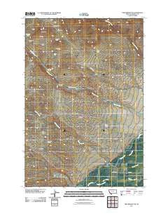
~ Twin Bridges SW MT topo map, 1:24000 scale, 7.5 X 7.5 Minute, Historical, 2011
Twin Bridges SW, Montana, USGS topographic map dated 2011.
Includes geographic coordinates (latitude and longitude). This topographic map is suitable for hiking, camping, and exploring, or framing it as a wall map.
Printed on-demand using high resolution imagery, on heavy weight and acid free paper, or alternatively on a variety of synthetic materials.
Topos available on paper, Waterproof, Poly, or Tyvek. Usually shipping rolled, unless combined with other folded maps in one order.
- Product Number: USGS-5260137
- Free digital map download (high-resolution, GeoPDF): Twin Bridges SW, Montana (file size: 12 MB)
- Map Size: please refer to the dimensions of the GeoPDF map above
- Weight (paper map): ca. 55 grams
- Map Type: POD USGS Topographic Map
- Map Series: US Topo
- Map Verison: Historical
- Cell ID: 46084
- Datum: North American Datum of 1983
- Map Projection: Transverse Mercator
- Map Cell Name: Twin Bridges SW
- Grid size: 7.5 X 7.5 Minute
- Date on map: 2011
- Map Scale: 1:24000
- Geographical region: Montana, United States
Neighboring Maps:
All neighboring USGS topo maps are available for sale online at a variety of scales.
Spatial coverage:
Topo map Twin Bridges SW, Montana, covers the geographical area associated the following places:
- Eclipse Mine - Full House Mine - Anything Mine - Muriers (historical) - NW Section 33 Mine - Monitor Mine - NW Section 15 Mine - Pennington Bridge Fishing Access Site - Hermit Mine - Pageville School (historical) - Pageville Post Office (historical) - 03S07W05DCDB01 Spring - NE Section 4 Mine - Never Fail Mine - Rock Spring Ranch - Sunbeam/ID Number 2 Mine - Ellen Marshall Mine - NW Section 5 Mine - NW Section 26 Mine - End Mine - SW Section 9 Mine - Elizabeth Mine - Idler Mine - SW Section 3 Mine - Alaska Mine - Nez Perce Creek - Crystal Mine
- Map Area ID: AREA45.62545.5-112.5-112.375
- Northwest corner Lat/Long code: USGSNW45.625-112.5
- Northeast corner Lat/Long code: USGSNE45.625-112.375
- Southwest corner Lat/Long code: USGSSW45.5-112.5
- Southeast corner Lat/Long code: USGSSE45.5-112.375
- Northern map edge Latitude: 45.625
- Southern map edge Latitude: 45.5
- Western map edge Longitude: -112.5
- Eastern map edge Longitude: -112.375


