
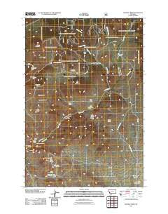
~ Wickiup Creek MT topo map, 1:24000 scale, 7.5 X 7.5 Minute, Historical, 2011
Wickiup Creek, Montana, USGS topographic map dated 2011.
Includes geographic coordinates (latitude and longitude). This topographic map is suitable for hiking, camping, and exploring, or framing it as a wall map.
Printed on-demand using high resolution imagery, on heavy weight and acid free paper, or alternatively on a variety of synthetic materials.
Topos available on paper, Waterproof, Poly, or Tyvek. Usually shipping rolled, unless combined with other folded maps in one order.
- Product Number: USGS-5259938
- Free digital map download (high-resolution, GeoPDF): Wickiup Creek, Montana (file size: 16 MB)
- Map Size: please refer to the dimensions of the GeoPDF map above
- Weight (paper map): ca. 55 grams
- Map Type: POD USGS Topographic Map
- Map Series: US Topo
- Map Verison: Historical
- Cell ID: 48952
- Datum: North American Datum of 1983
- Map Projection: Transverse Mercator
- Map Cell Name: Wickiup Creek
- Grid size: 7.5 X 7.5 Minute
- Date on map: 2011
- Map Scale: 1:24000
- Geographical region: Montana, United States
Neighboring Maps:
All neighboring USGS topo maps are available for sale online at a variety of scales.
Spatial coverage:
Topo map Wickiup Creek, Montana, covers the geographical area associated the following places:
- Spring Mine - SW NE Section 32 Mine - SW SE Section 17 Mine - Summit/Mount Hecla Mine - SE SW Section 2 Mine - Clipper Mine - Willow Creek - Negro Mountain - Locust-Assey Mine - Yellow Metal Mine - NE NE Section 28 Mine - Cow Camp - SW SE Section 21 Mine - Columbia Mine - SW NE Section 11 Mine - Wickiup Creek - Little Camp Creek - SE SW Section 3 Mine - NE SW Section 4 Mine - Smith Dam - Pandora/Pilon Mine - NE NW Section 11 Mine - NW SE Section 28 Mine - NE NE Section 8 Mine - Moffet Gulch - SE SW Section 29 Mine - Lizzie Ann Mine - NE NE Section 20 Mine - Pandora Mountain - SW NE Section 28 Mine - Sawmill Gulch - NE SE Section 29 Mine - SE SW Section 12 Mine - NW SW Section 28 Mine - NE NW Section 20 Mine - Moffet Mountain - Norwood Post Office (historical) - King and Queen Hill - SE SE Section 17 Mine - Blacktail Creek - Penobscot Mine - NE SW Section 21 Mine
- Map Area ID: AREA45.7545.625-112.625-112.5
- Northwest corner Lat/Long code: USGSNW45.75-112.625
- Northeast corner Lat/Long code: USGSNE45.75-112.5
- Southwest corner Lat/Long code: USGSSW45.625-112.625
- Southeast corner Lat/Long code: USGSSE45.625-112.5
- Northern map edge Latitude: 45.75
- Southern map edge Latitude: 45.625
- Western map edge Longitude: -112.625
- Eastern map edge Longitude: -112.5


