
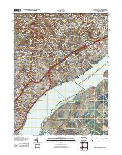
~ Marcus Hook PA topo map, 1:24000 scale, 7.5 X 7.5 Minute, Historical, 2011
Marcus Hook, Pennsylvania, USGS topographic map dated 2011.
Includes geographic coordinates (latitude and longitude). This topographic map is suitable for hiking, camping, and exploring, or framing it as a wall map.
Printed on-demand using high resolution imagery, on heavy weight and acid free paper, or alternatively on a variety of synthetic materials.
Topos available on paper, Waterproof, Poly, or Tyvek. Usually shipping rolled, unless combined with other folded maps in one order.
- Product Number: USGS-5258507
- Free digital map download (high-resolution, GeoPDF): Marcus Hook, Pennsylvania (file size: 22 MB)
- Map Size: please refer to the dimensions of the GeoPDF map above
- Weight (paper map): ca. 55 grams
- Map Type: POD USGS Topographic Map
- Map Series: US Topo
- Map Verison: Historical
- Cell ID: 27653
- Datum: North American Datum of 1983
- Map Projection: Transverse Mercator
- Map Cell Name: Marcus Hook
- Grid size: 7.5 X 7.5 Minute
- Date on map: 2011
- Map Scale: 1:24000
- Geographical region: Pennsylvania, United States
Neighboring Maps:
All neighboring USGS topo maps are available for sale online at a variety of scales.
Spatial coverage:
Topo map Marcus Hook, Pennsylvania, covers the geographical area associated the following places:
- Trainer - Maplechase - Woodstream Gardens - Stockdale - Claymont Village - Grubbs Corner - Greentree - Darley Woods - Grubbs Landing - Holly Hills - Crestfield - Wycliff - KynLyn Apartments - Seton - Valley Run - Pedricktown - Penrock - Bellevue Hills - Riviera at Concord - Parkridge at Bellevue - Claymont Addition - Brookview - Claymont Manor - Aston Mills - Garnet Valley - Afton - Morgan - Hiddencreek - Ashbourne Hills - The Hills at Bethel - Greenshire - Parkside - Goodley Manor - Duponts Landing - Claymont Heights - Radnor Green - Northhurst - Ardentown - Highland Woods - Riverside - Green Ridge - The Timbers - Seton Villa - Holly Oak - Woodside Hills - Silverside - South Chester - Northcrest - Indian Field - Cragmere Woods - Creekside Village at Naamans - Nortonville - Hilltop Manor - Gardendale - Glen Estates - Overlook Colony - Brookhaven - Claymont - Aston Arms - White Village - Marcus Hook - Holly Oak Terrace - Edgemoor Gardens - Riverview Gardens - Chester Plaza - Ballymeade - Five Points - Kings Ridge - Wembly - Naaman - Bigger Tract - Bridgewater - Feltonville - Hillendale - Carpenter - Linwood - Woodacres - Zebleys Corner - Beverly Woods - Addick Estates - Lindamere - Cragmere - Analine Village - Clair Manor - Munsee - Lancashire - Grubbs Corner - Quarryville - Brandywine Estates - Scots Glen - Princeton Estates - Village Green - Green Acres - Westerloo - Greenmount - Garnet Oaks - Boothwyn - Ramble Woods - Fisher Corners - Buckingham Heights
- Map Area ID: AREA39.87539.75-75.5-75.375
- Northwest corner Lat/Long code: USGSNW39.875-75.5
- Northeast corner Lat/Long code: USGSNE39.875-75.375
- Southwest corner Lat/Long code: USGSSW39.75-75.5
- Southeast corner Lat/Long code: USGSSE39.75-75.375
- Northern map edge Latitude: 39.875
- Southern map edge Latitude: 39.75
- Western map edge Longitude: -75.5
- Eastern map edge Longitude: -75.375


