
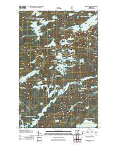
~ Ojibway Lake MN topo map, 1:24000 scale, 7.5 X 7.5 Minute, Historical, 2011
Ojibway Lake, Minnesota, USGS topographic map dated 2011.
Includes geographic coordinates (latitude and longitude). This topographic map is suitable for hiking, camping, and exploring, or framing it as a wall map.
Printed on-demand using high resolution imagery, on heavy weight and acid free paper, or alternatively on a variety of synthetic materials.
Topos available on paper, Waterproof, Poly, or Tyvek. Usually shipping rolled, unless combined with other folded maps in one order.
- Product Number: USGS-5257895
- Free digital map download (high-resolution, GeoPDF): Ojibway Lake, Minnesota (file size: 22 MB)
- Map Size: please refer to the dimensions of the GeoPDF map above
- Weight (paper map): ca. 55 grams
- Map Type: POD USGS Topographic Map
- Map Series: US Topo
- Map Verison: Historical
- Cell ID: 32996
- Datum: North American Datum of 1983
- Map Projection: Transverse Mercator
- Map Cell Name: Ojibway Lake
- Grid size: 7.5 X 7.5 Minute
- Date on map: 2011
- Map Scale: 1:24000
- Geographical region: Minnesota, United States
Neighboring Maps:
All neighboring USGS topo maps are available for sale online at a variety of scales.
Spatial coverage:
Topo map Ojibway Lake, Minnesota, covers the geographical area associated the following places:
- Weasel Lake - Uncle Judas Creek - Kamimela Lake - Wedge Lake - Triangle Lake - Moose Lake - Cortes Lake - Lark Lake - Ojibway Lake - Jewell Lake - Rookie Lake - Gem Lake - Hula Lake - Pagami Lake - Astray Lake - Jasper Lake - Glacier Pond - Pagami Creek - Dan Lake - Madden Creek - Greenstone Lake - Clearwater Lake - Plukesley Lake - Uranus Lake - Finch Lake - Refuge Pond - Madden Lake - Jasper Creek - Conchu Lake - Upper Uranus Lake - Carefree Lake - Wood Lake - Witness Lake - Section Twelve Lake - Tofte Lake
- Map Area ID: AREA4847.875-91.625-91.5
- Northwest corner Lat/Long code: USGSNW48-91.625
- Northeast corner Lat/Long code: USGSNE48-91.5
- Southwest corner Lat/Long code: USGSSW47.875-91.625
- Southeast corner Lat/Long code: USGSSE47.875-91.5
- Northern map edge Latitude: 48
- Southern map edge Latitude: 47.875
- Western map edge Longitude: -91.625
- Eastern map edge Longitude: -91.5


