
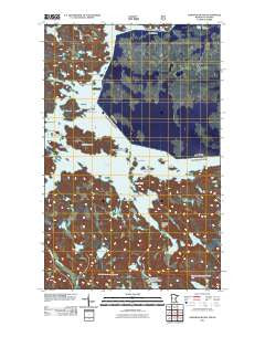
~ Namakan Island MN topo map, 1:24000 scale, 7.5 X 7.5 Minute, Historical, 2011
Namakan Island, Minnesota, USGS topographic map dated 2011.
Includes geographic coordinates (latitude and longitude). This topographic map is suitable for hiking, camping, and exploring, or framing it as a wall map.
Printed on-demand using high resolution imagery, on heavy weight and acid free paper, or alternatively on a variety of synthetic materials.
Topos available on paper, Waterproof, Poly, or Tyvek. Usually shipping rolled, unless combined with other folded maps in one order.
- Product Number: USGS-5257875
- Free digital map download (high-resolution, GeoPDF): Namakan Island, Minnesota (file size: 18 MB)
- Map Size: please refer to the dimensions of the GeoPDF map above
- Weight (paper map): ca. 55 grams
- Map Type: POD USGS Topographic Map
- Map Series: US Topo
- Map Verison: Historical
- Cell ID: 31283
- Datum: North American Datum of 1983
- Map Projection: Transverse Mercator
- Map Cell Name: Namakan Island
- Grid size: 7.5 X 7.5 Minute
- Date on map: 2011
- Map Scale: 1:24000
- Geographical region: Minnesota, United States
Neighboring Maps:
All neighboring USGS topo maps are available for sale online at a variety of scales.
Spatial coverage:
Topo map Namakan Island, Minnesota, covers the geographical area associated the following places:
- Net Lake - Hamilton Island - Kettle Falls - Weir Lake - Hoist Bay - Tooth Lake - Bivo Island - Voyageur Narrows - Johnson Bay - Sexton Island - Namakan Lake - Mica Island - McManus Island - Gold Island - Jug Island - Postage Island - Namakan Island - Gagnon Island - Twin Alligator Island - Kettle Falls Dam - Wiyapka Lake - Junction Bay - Sheen Island - Alden Island - Squirrel Narrows - Strawberry Island - Stevens Island - Wolf Pack Islands - Fox Island - Kubel Island - Johnson River - Namakan Seaplane Base - Randolph Bay - Gehering Point - Sheen Point - Wigwam Island - Magie Island
- Map Area ID: AREA48.548.375-92.75-92.625
- Northwest corner Lat/Long code: USGSNW48.5-92.75
- Northeast corner Lat/Long code: USGSNE48.5-92.625
- Southwest corner Lat/Long code: USGSSW48.375-92.75
- Southeast corner Lat/Long code: USGSSE48.375-92.625
- Northern map edge Latitude: 48.5
- Southern map edge Latitude: 48.375
- Western map edge Longitude: -92.75
- Eastern map edge Longitude: -92.625


