
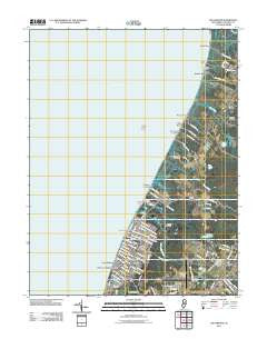
~ Rio Grande NJ topo map, 1:24000 scale, 7.5 X 7.5 Minute, Historical, 2011
Rio Grande, New Jersey, USGS topographic map dated 2011.
Includes geographic coordinates (latitude and longitude). This topographic map is suitable for hiking, camping, and exploring, or framing it as a wall map.
Printed on-demand using high resolution imagery, on heavy weight and acid free paper, or alternatively on a variety of synthetic materials.
Topos available on paper, Waterproof, Poly, or Tyvek. Usually shipping rolled, unless combined with other folded maps in one order.
- Product Number: USGS-5256901
- Free digital map download (high-resolution, GeoPDF): Rio Grande, New Jersey (file size: 15 MB)
- Map Size: please refer to the dimensions of the GeoPDF map above
- Weight (paper map): ca. 55 grams
- Map Type: POD USGS Topographic Map
- Map Series: US Topo
- Map Verison: Historical
- Cell ID: 37975
- Datum: North American Datum of 1983
- Map Projection: Transverse Mercator
- Map Cell Name: Rio Grande
- Grid size: 7.5 X 7.5 Minute
- Date on map: 2011
- Map Scale: 1:24000
- Geographical region: New Jersey, United States
Neighboring Maps:
All neighboring USGS topo maps are available for sale online at a variety of scales.
Spatial coverage:
Topo map Rio Grande, New Jersey, covers the geographical area associated the following places:
- Pierces - Sally Marshall Crossing - Kimseytown - Bowman Manor - Kimbles Beach - King Crab Landing - Highs Beach - Reeds Beach - Miami Beach - North Highlands Beach - Rio Grande - Villas - Del Haven - Erma Park - Norburys Landing - Fishing Creek - Nummytown - Pierces Point - Green Creek - Dias Creek - Wildwood Highlands Beach
- Map Area ID: AREA39.12539-75-74.875
- Northwest corner Lat/Long code: USGSNW39.125-75
- Northeast corner Lat/Long code: USGSNE39.125-74.875
- Southwest corner Lat/Long code: USGSSW39-75
- Southeast corner Lat/Long code: USGSSE39-74.875
- Northern map edge Latitude: 39.125
- Southern map edge Latitude: 39
- Western map edge Longitude: -75
- Eastern map edge Longitude: -74.875


