
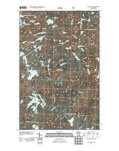
~ Lake Polly MN topo map, 1:24000 scale, 7.5 X 7.5 Minute, Historical, 2011
Lake Polly, Minnesota, USGS topographic map dated 2011.
Includes geographic coordinates (latitude and longitude). This topographic map is suitable for hiking, camping, and exploring, or framing it as a wall map.
Printed on-demand using high resolution imagery, on heavy weight and acid free paper, or alternatively on a variety of synthetic materials.
Topos available on paper, Waterproof, Poly, or Tyvek. Usually shipping rolled, unless combined with other folded maps in one order.
- Product Number: USGS-5256145
- Free digital map download (high-resolution, GeoPDF): Lake Polly, Minnesota (file size: 20 MB)
- Map Size: please refer to the dimensions of the GeoPDF map above
- Weight (paper map): ca. 55 grams
- Map Type: POD USGS Topographic Map
- Map Series: US Topo
- Map Verison: Historical
- Cell ID: 24624
- Datum: North American Datum of 1983
- Map Projection: Transverse Mercator
- Map Cell Name: Lake Polly
- Grid size: 7.5 X 7.5 Minute
- Date on map: 2011
- Map Scale: 1:24000
- Geographical region: Minnesota, United States
Neighboring Maps:
All neighboring USGS topo maps are available for sale online at a variety of scales.
Spatial coverage:
Topo map Lake Polly, Minnesota, covers the geographical area associated the following places:
- Lake Polly - Coot Lake - Boze Lake - Whopper Lake - Wapata Lake - Fantail Lake - Rail Lake - Phoebe River - Peron Lake - Grunt Lake - Blue Jay Lake - Bug Lake - Whelp Creek - Pointer Lake - Townline Lake - Frond Lake - Saddle Lake - Cowan Lake - Hazel Lake - Shoveller Lake - Sova Lake - Blue Jay Creek - Malberg Lake - Louse River - Koma Lake - Trail Lake - Edge Lake - Panhandle Lake - John Elk Lake - Lean Lake - Mirth Lake - Wolverine Lake - Tool Lake - Snort Lake - Anit Lake - Kickshaw Lake - Humpback Lake - Vein Lake - Bowstring Lake - Fable Lake - Redstart Lake - Kivandeba Lake - Blue Wing Lake - Pan Lake - Barto Creek - Minnesota State Forest - Hat Lake - Kivaniva Lake
- Map Area ID: AREA4847.875-91.125-91
- Northwest corner Lat/Long code: USGSNW48-91.125
- Northeast corner Lat/Long code: USGSNE48-91
- Southwest corner Lat/Long code: USGSSW47.875-91.125
- Southeast corner Lat/Long code: USGSSE47.875-91
- Northern map edge Latitude: 48
- Southern map edge Latitude: 47.875
- Western map edge Longitude: -91.125
- Eastern map edge Longitude: -91


