
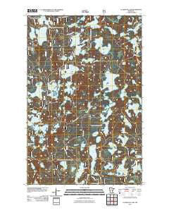
~ Clubhouse Lake MN topo map, 1:24000 scale, 7.5 X 7.5 Minute, Historical, 2011
Clubhouse Lake, Minnesota, USGS topographic map dated 2011.
Includes geographic coordinates (latitude and longitude). This topographic map is suitable for hiking, camping, and exploring, or framing it as a wall map.
Printed on-demand using high resolution imagery, on heavy weight and acid free paper, or alternatively on a variety of synthetic materials.
Topos available on paper, Waterproof, Poly, or Tyvek. Usually shipping rolled, unless combined with other folded maps in one order.
- Product Number: USGS-5255905
- Free digital map download (high-resolution, GeoPDF): Clubhouse Lake, Minnesota (file size: 23 MB)
- Map Size: please refer to the dimensions of the GeoPDF map above
- Weight (paper map): ca. 55 grams
- Map Type: POD USGS Topographic Map
- Map Series: US Topo
- Map Verison: Historical
- Cell ID: 9290
- Datum: North American Datum of 1983
- Map Projection: Transverse Mercator
- Map Cell Name: Clubhouse Lake
- Grid size: 7.5 X 7.5 Minute
- Date on map: 2011
- Map Scale: 1:24000
- Geographical region: Minnesota, United States
Neighboring Maps:
All neighboring USGS topo maps are available for sale online at a variety of scales.
Spatial coverage:
Topo map Clubhouse Lake, Minnesota, covers the geographical area associated the following places:
- Burns Lake - Gunn Lake - Copenhagen Lake - Crooked Lake - Chickadee Lake - Northome Lake - Heinen Lake - Clubhouse Lake Campground - Dock Lake - Baldy Lake - Horseshoe Lake - McKewen Lake - Duck Lake - Little Sand Lake - Ruby Lake - Little Burnt Shanty Lake - Little Ole Lake - East Lake - Little Island Lake - Mink Lake - Ghost Lake - Pughole Lake - Hill Lake - My Lake - William Lake - Burns Lake Seaplane Base - Little Ruby Lake - Telephone Lake - Black Island Lake - Fly Lake - Little Arm Lake - Big Dick Lake - Little Clubhouse Lake - Charlie Lake - South Smith Lake - Doe Lake - George Lake - Highland Lake - Three Island Lake - Lake Elizabeth - Duck Lake - Little Dick Lake - Pine Lake - Little East Lake - Three Island Lake - Little McKewen Lake - Oak Lake - Release Post Office (historical) - Muskrat Lake - Clubhouse Lake - Silver Lake - East Smith Lake - Brown Lake - Smith Lake - Nose Lake - Allen Lake - Fox Lake - Linden Lake - Big Ole Lake - No Mans Lake - Fishhook Lake - Blind Lake - Blue Rock Lake - Raft Lake - Big Island Lake - Big Jack Lake - Burnt Shanty Lake - Pickerel Lake - Lebarge Lake - Little Bass Lake - Oar Lake - Mikes Lake - Lost Moose Lake
- Map Area ID: AREA47.62547.5-93.625-93.5
- Northwest corner Lat/Long code: USGSNW47.625-93.625
- Northeast corner Lat/Long code: USGSNE47.625-93.5
- Southwest corner Lat/Long code: USGSSW47.5-93.625
- Southeast corner Lat/Long code: USGSSE47.5-93.5
- Northern map edge Latitude: 47.625
- Southern map edge Latitude: 47.5
- Western map edge Longitude: -93.625
- Eastern map edge Longitude: -93.5


