
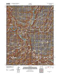
~ Red Canyon CO topo map, 1:24000 scale, 7.5 X 7.5 Minute, Historical, 2011
Red Canyon, Colorado, USGS topographic map dated 2011.
Includes geographic coordinates (latitude and longitude). This topographic map is suitable for hiking, camping, and exploring, or framing it as a wall map.
Printed on-demand using high resolution imagery, on heavy weight and acid free paper, or alternatively on a variety of synthetic materials.
Topos available on paper, Waterproof, Poly, or Tyvek. Usually shipping rolled, unless combined with other folded maps in one order.
- Product Number: USGS-5255869
- Free digital map download (high-resolution, GeoPDF): Red Canyon, Colorado (file size: 34 MB)
- Map Size: please refer to the dimensions of the GeoPDF map above
- Weight (paper map): ca. 55 grams
- Map Type: POD USGS Topographic Map
- Map Series: US Topo
- Map Verison: Historical
- Cell ID: 71358
- Datum: North American Datum of 1983
- Map Projection: Transverse Mercator
- Map Cell Name: Red Canyon
- Grid size: 7.5 X 7.5 Minute
- Date on map: 2011
- Map Scale: 1:24000
- Geographical region: Colorado, United States
Neighboring Maps:
All neighboring USGS topo maps are available for sale online at a variety of scales.
Spatial coverage:
Topo map Red Canyon, Colorado, covers the geographical area associated the following places:
- Red Sox Mine - Club Sandwich Mine - Little Dick Mine - Radium Queen Mine - North Star Mine - Worcester Mine - Eulla Belle Mine - Beehive Canyon - Long Shot Mine - Sewemup Stock Trail - Tuesday Mine - Little Buckhorn Mine - Last Chance Mine - Radium King Mine - Shamrock Mines - Atkinson Mesa - Bowen Mine - North Fork Mesa Creek - Fox Mine - Margie Mine - Farmer Girl Mine - Red Rock Number 5 Mine - Betty Jean Mine - Golden Cycle Mine - Margie Two Mine - Mesa Creek - Wildcat Number 3 Mine - Piper Mine - Lucky Dog Mine - Ophir Mine - Lone Tree Mesa - Roc Creek - San Miguel River - Shamrock Mine - Black Rock Mine - Abajo One-five Mine - Club Ranch - Buckhorn Mine - Belva Mine - East Mesa Creek - Shamrock Mine - Horse Mesa - Big Dick Mine - Joe Mine - Foster Mine - South Fork Mesa Creek - Index Mine - Sandy Mine - Red Rock Number 2 Mine - Alta Mine - Ravin Mine - King Solomon Mine - Red Canyon Mine - Dolores Mines - Dry Fork Mesa Creek - Town House Mine - Wildcat Number 8 Mine - Radium Trail - Bauer Mine - Yankee Mine - Adak Mine - Moon Canyon - Bluebird Mine - Jo Anne Mine - Pablo Mine - Red Canyon - Outlet Mine - Blue Mesa - Atkinson Creek - Sunbeam Group Mines - Cliff Dweller Mine - Dolores Mine - Nucle Mine
- Map Area ID: AREA38.538.375-108.875-108.75
- Northwest corner Lat/Long code: USGSNW38.5-108.875
- Northeast corner Lat/Long code: USGSNE38.5-108.75
- Southwest corner Lat/Long code: USGSSW38.375-108.875
- Southeast corner Lat/Long code: USGSSE38.375-108.75
- Northern map edge Latitude: 38.5
- Southern map edge Latitude: 38.375
- Western map edge Longitude: -108.875
- Eastern map edge Longitude: -108.75


