
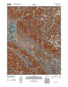
~ Davis Mesa CO topo map, 1:24000 scale, 7.5 X 7.5 Minute, Historical, 2011
Davis Mesa, Colorado, USGS topographic map dated 2011.
Includes geographic coordinates (latitude and longitude). This topographic map is suitable for hiking, camping, and exploring, or framing it as a wall map.
Printed on-demand using high resolution imagery, on heavy weight and acid free paper, or alternatively on a variety of synthetic materials.
Topos available on paper, Waterproof, Poly, or Tyvek. Usually shipping rolled, unless combined with other folded maps in one order.
- Product Number: USGS-5255859
- Free digital map download (high-resolution, GeoPDF): Davis Mesa, Colorado (file size: 35 MB)
- Map Size: please refer to the dimensions of the GeoPDF map above
- Weight (paper map): ca. 55 grams
- Map Type: POD USGS Topographic Map
- Map Series: US Topo
- Map Verison: Historical
- Cell ID: 11440
- Datum: North American Datum of 1983
- Map Projection: Transverse Mercator
- Map Cell Name: Davis Mesa
- Grid size: 7.5 X 7.5 Minute
- Date on map: 2011
- Map Scale: 1:24000
- Geographical region: Colorado, United States
Neighboring Maps:
All neighboring USGS topo maps are available for sale online at a variety of scales.
Spatial coverage:
Topo map Davis Mesa, Colorado, covers the geographical area associated the following places:
- Ball Point Mine - Burnette Number Five Mine - Half Shot Mine - Fort Number One Mine - West Paradox Creek - Honeymoon Dumps Mine - CFC Mine - Dynamite Mine - Helen C Mine - Columbia Mine - Maggie C Dump Mine - Surprise Number One Mine - Silver Dollar Mine - West Lode - Coloradium Mine - Fawn Springs Number Ten Mine - Badger Dump Mine - Tramp Mine - Black Diana Mine - Kern Mine - Tramp Dumps Mine - Davis Mesa - Tripod Mine - Groundhog Mine - Donald L Dump Mine - Republican Dump Mine - Pie Face Mine - Stone Spring - Cripple Creek Dump Mine - TNT Number 3 Mine - Washburn Mine - Camp Marvel Carnotite Mine - TM Mine - Henry Clay Dumps Mine - Martin Mesa - Valentine Mine - Cripple Creek Mine - Henry Z Mine - Buck Shot Mine - Skein Mesa - Florence Nellie Mine - Happy Mine - Carleton Mine - Carmack Potash Mine - Rambler Mine - Mill Number 4 Mine - East Paradox Creek - Saucer Basin Mine - Moon Beem Mine - Vacation Mine - Hidden Basin Mine - Saucer Basin - TNT Number 1 Mine - Republican Mine - Monster Mine - Tramp Number 2 Mine - TNT Number 2 Mine - Gregory Creek - Sunshine Mine - Better Be Mine - Lucky Boulder Mine - Rambler Point Mine - Henry Clay Mine - Phonograph Mine - San Miguel Mine - Buckeye Mine - Dusty Mine - Firebird Mine - Dorothy Mine - Mill Number 2 Mine - Groundhog Mine - Honeymoon Mine - Monogram Mine - Club Number 7 Mine - North Star Mine - Peggie Group Mine - Corral Number 1 (historical) - Paradox Valley - Sharkey Mine - Grace Mine - Ram Mine - Vanadate Mine - Prospector Well - La Salle Mine - Pearl Walker Mine - Bobcat Mine - New Long Park Mine
- Map Area ID: AREA38.37538.25-108.875-108.75
- Northwest corner Lat/Long code: USGSNW38.375-108.875
- Northeast corner Lat/Long code: USGSNE38.375-108.75
- Southwest corner Lat/Long code: USGSSW38.25-108.875
- Southeast corner Lat/Long code: USGSSE38.25-108.75
- Northern map edge Latitude: 38.375
- Southern map edge Latitude: 38.25
- Western map edge Longitude: -108.875
- Eastern map edge Longitude: -108.75


