
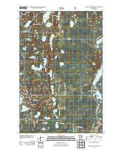
~ Lawrence Lake West MN topo map, 1:24000 scale, 7.5 X 7.5 Minute, Historical, 2011
Lawrence Lake West, Minnesota, USGS topographic map dated 2011.
Includes geographic coordinates (latitude and longitude). This topographic map is suitable for hiking, camping, and exploring, or framing it as a wall map.
Printed on-demand using high resolution imagery, on heavy weight and acid free paper, or alternatively on a variety of synthetic materials.
Topos available on paper, Waterproof, Poly, or Tyvek. Usually shipping rolled, unless combined with other folded maps in one order.
- Product Number: USGS-5254607
- Free digital map download (high-resolution, GeoPDF): Lawrence Lake West, Minnesota (file size: 20 MB)
- Map Size: please refer to the dimensions of the GeoPDF map above
- Weight (paper map): ca. 55 grams
- Map Type: POD USGS Topographic Map
- Map Series: US Topo
- Map Verison: Historical
- Cell ID: 25152
- Datum: North American Datum of 1983
- Map Projection: Transverse Mercator
- Map Cell Name: Lawrence Lake West
- Grid size: 7.5 X 7.5 Minute
- Date on map: 2011
- Map Scale: 1:24000
- Geographical region: Minnesota, United States
Neighboring Maps:
All neighboring USGS topo maps are available for sale online at a variety of scales.
Spatial coverage:
Topo map Lawrence Lake West, Minnesota, covers the geographical area associated the following places:
- Cutaway Lake - Rain Barrel Lake - McAlpine Lake - Township of Lawrence - Birch Lake - Hanson Lake Impoundment - Skeeter Lake - Hendrichs Lake - Wabana Lake - Hanson Lake - Wabana Lake Post Office (historical) - Murphy Lake - Rose Lake - Snaptail Lake - Little Wabana Lake - Wabana Post Office (historical) - Lawrence Lake - Inky Lake - Skeeter Lake Trail System - Minnow Lake - Arrowhead Lake - Little Wolf Lake - Clearwater Lake - Little Wolf Lake Wildlife Impondment Dam - Wabana Lake Dam - Lower Lawrence Lake - Wabana Creek - Lower Hanson Lake - Little Wolf Impoundment - Hanson Creek - Big Rain Barrel Lake - Sucker Brook - Shaughnessy Seaplane Base - Tadpole Lake - Upper Hanson Lake - Camerton Lake - Lawron Chapel - Plantation Lake - Little Inky Lake - Little Wolf Lake - Potato Lake - Middle Hanson Lake
- Map Area ID: AREA47.547.375-93.5-93.375
- Northwest corner Lat/Long code: USGSNW47.5-93.5
- Northeast corner Lat/Long code: USGSNE47.5-93.375
- Southwest corner Lat/Long code: USGSSW47.375-93.5
- Southeast corner Lat/Long code: USGSSE47.375-93.375
- Northern map edge Latitude: 47.5
- Southern map edge Latitude: 47.375
- Western map edge Longitude: -93.5
- Eastern map edge Longitude: -93.375


