
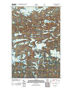
~ Gillis Lake MN topo map, 1:24000 scale, 7.5 X 7.5 Minute, Historical, 2011
Gillis Lake, Minnesota, USGS topographic map dated 2011.
Includes geographic coordinates (latitude and longitude). This topographic map is suitable for hiking, camping, and exploring, or framing it as a wall map.
Printed on-demand using high resolution imagery, on heavy weight and acid free paper, or alternatively on a variety of synthetic materials.
Topos available on paper, Waterproof, Poly, or Tyvek. Usually shipping rolled, unless combined with other folded maps in one order.
- Product Number: USGS-5249013
- Free digital map download (high-resolution, GeoPDF): Gillis Lake, Minnesota (file size: 17 MB)
- Map Size: please refer to the dimensions of the GeoPDF map above
- Weight (paper map): ca. 55 grams
- Map Type: POD USGS Topographic Map
- Map Series: US Topo
- Map Verison: Historical
- Cell ID: 17253
- Datum: North American Datum of 1983
- Map Projection: Transverse Mercator
- Map Cell Name: Gillis Lake
- Grid size: 7.5 X 7.5 Minute
- Date on map: 2011
- Map Scale: 1:24000
- Geographical region: Minnesota, United States
Neighboring Maps:
All neighboring USGS topo maps are available for sale online at a variety of scales.
Spatial coverage:
Topo map Gillis Lake, Minnesota, covers the geographical area associated the following places:
- Sea Gull Lake - Ogle Lake - Virgin Lake - Bingshick Lake - Pellet Lake - Gotter Lake - Fern Lake - Fay Lake - Glossy Lake - Hooter Lake - Tuscarora Lake - Fishgig Lake - Gillis Lake - Ellquist Lake - Ballyhoo Lake - Paulson Lake - Hummitch Lake - Owl Lake - Crooked Lake - Jimmy Lake - Mina Lake - Jerry Lake - Tarry Lake - Elusion Lake - Honker Lake - Flap Lake - Crag Lake - Whipped Lake - Howard Lake - Glee Lake - Rumpuss Lake - Bat Lake - Seahorse Lake - Rog Lake - Peter Lake - Elm Lake - Squat Lake - Jam Lake - Bonita Lake - Alpine Lake - Chip Lake - Powell Lake - Chub River - Rally Lake - Tern Lake - West Fern Lake - Warclub Lake - Ecstasy Lake - Acorn Lake - Everett Lake - Loop Lake - Arc Lake - French Lake - Jig Lake - Flint Lake - Flying Lake - Time Lake - Cavity Lake - Green Lake - Leaf Lake - Mora Lake
- Map Area ID: AREA48.12548-91-90.875
- Northwest corner Lat/Long code: USGSNW48.125-91
- Northeast corner Lat/Long code: USGSNE48.125-90.875
- Southwest corner Lat/Long code: USGSSW48-91
- Southeast corner Lat/Long code: USGSSE48-90.875
- Northern map edge Latitude: 48.125
- Southern map edge Latitude: 48
- Western map edge Longitude: -91
- Eastern map edge Longitude: -90.875


