
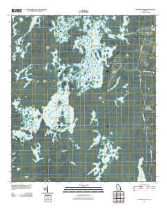
~ Chesser Island GA topo map, 1:24000 scale, 7.5 X 7.5 Minute, Historical, 2011
Chesser Island, Georgia, USGS topographic map dated 2011.
Includes geographic coordinates (latitude and longitude). This topographic map is suitable for hiking, camping, and exploring, or framing it as a wall map.
Printed on-demand using high resolution imagery, on heavy weight and acid free paper, or alternatively on a variety of synthetic materials.
Topos available on paper, Waterproof, Poly, or Tyvek. Usually shipping rolled, unless combined with other folded maps in one order.
- Product Number: USGS-5247711
- Free digital map download (high-resolution, GeoPDF): Chesser Island, Georgia (file size: 18 MB)
- Map Size: please refer to the dimensions of the GeoPDF map above
- Weight (paper map): ca. 55 grams
- Map Type: POD USGS Topographic Map
- Map Series: US Topo
- Map Verison: Historical
- Cell ID: 8397
- Datum: North American Datum of 1983
- Map Projection: Transverse Mercator
- Map Cell Name: Chesser Island
- Grid size: 7.5 X 7.5 Minute
- Date on map: 2011
- Map Scale: 1:24000
- Geographical region: Georgia, United States
Neighboring Maps:
All neighboring USGS topo maps are available for sale online at a variety of scales.
Spatial coverage:
Topo map Chesser Island, Georgia, covers the geographical area associated the following places:
- Coward Lake - Charles Island - Gannet Lake - Big Cypress Lake - Double Lake - Cooter Lake - Goose House Gap - Buzzards Roost Lake - Horse Island - Monkey Lake - Stump Lake - Burnett Lake - Suwannee Canal Recreation Area - Number One Island - Seagrove Lake - Chesser Island - Chesser Prairie - Mitchell Island - Grand Prairie - Trout Lake - Buck Prairie - Little Cooter Lake - Buck Lake - Trout Lake Prairie - Coward Lake Prairie - Hog Island - Tar Lake - Big Cypress Camp Island - Camp Cornelia - Little Island - Chesser School (historical)
- Map Area ID: AREA30.7530.625-82.25-82.125
- Northwest corner Lat/Long code: USGSNW30.75-82.25
- Northeast corner Lat/Long code: USGSNE30.75-82.125
- Southwest corner Lat/Long code: USGSSW30.625-82.25
- Southeast corner Lat/Long code: USGSSE30.625-82.125
- Northern map edge Latitude: 30.75
- Southern map edge Latitude: 30.625
- Western map edge Longitude: -82.25
- Eastern map edge Longitude: -82.125


