
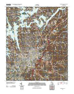
~ Gainesville GA topo map, 1:24000 scale, 7.5 X 7.5 Minute, Historical, 2011
Gainesville, Georgia, USGS topographic map dated 2011.
Includes geographic coordinates (latitude and longitude). This topographic map is suitable for hiking, camping, and exploring, or framing it as a wall map.
Printed on-demand using high resolution imagery, on heavy weight and acid free paper, or alternatively on a variety of synthetic materials.
Topos available on paper, Waterproof, Poly, or Tyvek. Usually shipping rolled, unless combined with other folded maps in one order.
- Product Number: USGS-5246337
- Free digital map download (high-resolution, GeoPDF): Gainesville, Georgia (file size: 18 MB)
- Map Size: please refer to the dimensions of the GeoPDF map above
- Weight (paper map): ca. 55 grams
- Map Type: POD USGS Topographic Map
- Map Series: US Topo
- Map Verison: Historical
- Cell ID: 16647
- Datum: North American Datum of 1983
- Map Projection: Transverse Mercator
- Map Cell Name: Gainesville
- Grid size: 7.5 X 7.5 Minute
- Date on map: 2011
- Map Scale: 1:24000
- Geographical region: Georgia, United States
Neighboring Maps:
All neighboring USGS topo maps are available for sale online at a variety of scales.
Spatial coverage:
Topo map Gainesville, Georgia, covers the geographical area associated the following places:
- Scoutland - Clarks Bridge - Waterford - Shady Valley - Thompson Mill - White Sands - Chapman - Northcliff Colony - Quiet Place in the Woods - Tapawingo - Morning Side Hills - Dixie Hills - Lakeshore Estates - Riverbend - Kemp - Gower Springs (historical) - New Holland - Northlake - Shady Lane - Fox Hollow - Chattahoochee Place - Botany Woods - Country Club Gardens - The Bluffs - Sagamore - Pine Point - Mill Creek - Gainesville - Frontier Trail - White Sulphur Springs - Tumlin Heights - Holland - Blueberry Hills - White Sulphur - North Banks Cove - Griffin Heights - Surf Side Club Estates - Happy Valley - Chattahoochee Landing - Laurel Hills - Chicopee - Lanier Valley - Gainesville Mills - Ahaluna - Barrett - Shamrock Heights - Cherrywood - Beverly Hills - Westgate - Lakeland Heights - Wild Fern - Cherokee Meadows - Rabbitown - Woodlake - Mooney - Atlas Circle - Stevens - Lanier North Woods - Sundown on Lanier - Greenway - Spring View Acres - Bailey - White Sulphur Station (historical) - Oakhill - River Point - Tyner - Green Hills - Greystone - Sunset Heights - Wildwood Heights - Fleetwood - Camellia Heights - Hayes - Rainbow Village - Chestnut Oak Hills - Le Dan - Cascade Woods - Westside
- Map Area ID: AREA34.37534.25-83.875-83.75
- Northwest corner Lat/Long code: USGSNW34.375-83.875
- Northeast corner Lat/Long code: USGSNE34.375-83.75
- Southwest corner Lat/Long code: USGSSW34.25-83.875
- Southeast corner Lat/Long code: USGSSE34.25-83.75
- Northern map edge Latitude: 34.375
- Southern map edge Latitude: 34.25
- Western map edge Longitude: -83.875
- Eastern map edge Longitude: -83.75


