
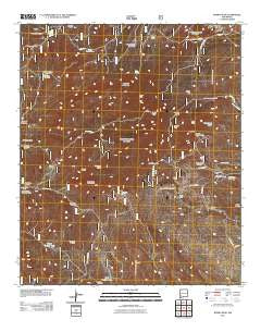
~ Burro Peak NM topo map, 1:24000 scale, 7.5 X 7.5 Minute, Historical, 2011
Burro Peak, New Mexico, USGS topographic map dated 2011.
Includes geographic coordinates (latitude and longitude). This topographic map is suitable for hiking, camping, and exploring, or framing it as a wall map.
Printed on-demand using high resolution imagery, on heavy weight and acid free paper, or alternatively on a variety of synthetic materials.
Topos available on paper, Waterproof, Poly, or Tyvek. Usually shipping rolled, unless combined with other folded maps in one order.
- Product Number: USGS-5246019
- Free digital map download (high-resolution, GeoPDF): Burro Peak, New Mexico (file size: 29 MB)
- Map Size: please refer to the dimensions of the GeoPDF map above
- Weight (paper map): ca. 55 grams
- Map Type: POD USGS Topographic Map
- Map Series: US Topo
- Map Verison: Historical
- Cell ID: 6392
- Datum: North American Datum of 1983
- Map Projection: Transverse Mercator
- Map Cell Name: Burro Peak
- Grid size: 7.5 X 7.5 Minute
- Date on map: 2011
- Map Scale: 1:24000
- Geographical region: New Mexico, United States
Neighboring Maps:
All neighboring USGS topo maps are available for sale online at a variety of scales.
Spatial coverage:
Topo map Burro Peak, New Mexico, covers the geographical area associated the following places:
- Sawmill Canyon - Goat Camp Windmill - Tank Number One - Silsby Ranch - Walking X Ranch - Gold Gulch Windmill - 00988 Water Well - S Big Burro Mountains Euxenite Deposit - McCauley Ranch - Merry Widow Mine - Silver Dollar Mine - Red Hill Turquoise Mine - Pine Canyon Windmill - Sunset Gold Field - Copeland Tank - Austin Amazon Mines - Hop Williams Mine - Shrine - Deadman Canyon Shafts and Prospect - Russel Ranch - Gold Gulch Placer - Wild Irishman Number 5 Shafts - Floyd Collins Mine - Thompson Windmill - Burro Peak - Arrastre Windmill - 00989 Water Well - Merry Widow Shaft - Summit Deposit - Spar Hill Mine - Rustler Canyon - Burro Mountain Homestead - Walnut Creek Windmill - Uncle Jimmy Thwaits Mine - Gold Gulch Spring - Red Hill - Mud Spring - Sprouse Mine - Ferguson Mountain - Neglected Mine - KXKK-FM (Lordsburg) - Section Fifteen Windmill - Jacks Peak - John Malone Shaft - Grapevine Spring - Copeland Mine - Rustler Spring - Thompson Canyon Windmill - Silver Dollar Mine - Knight Canyon Tank - Indian Hill
- Map Area ID: AREA32.62532.5-108.5-108.375
- Northwest corner Lat/Long code: USGSNW32.625-108.5
- Northeast corner Lat/Long code: USGSNE32.625-108.375
- Southwest corner Lat/Long code: USGSSW32.5-108.5
- Southeast corner Lat/Long code: USGSSE32.5-108.375
- Northern map edge Latitude: 32.625
- Southern map edge Latitude: 32.5
- Western map edge Longitude: -108.5
- Eastern map edge Longitude: -108.375


